Hildburghausen geodata
Hildburghausen (Thuringia) is a populated place; located in Germany in Europe/Berlin (GMT+2) time zone. With population of 12,171 people, there are 1343 cities with bigger population in this country. Compared to other cities in Germany, 54.2% of cities are located further ↑North; 63% of cities are located further ←West and 73.6% of cities have lower elevation than Hildburghausen. Note1
Administrative division(s):
- Level 1: Thuringia
- Level 3: Landkreis Hildburghausen
- Level 4: Hildburghausen


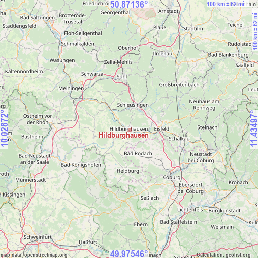
Hildburghausen GPS coordinates[2]
50° 25' 31.908" North, 10° 43' 54.624" East
| Map corner | latitude | longitude |
|---|---|---|
| Upper-left | 50.87136°, | 10.02872° |
| Center: | 50.42553°, | 10.73184° |
| Lower-right: | 49.97546°, | 11.43497° |
| Map W x H: | 99.6×99.6 km | = 61.9×61.9mi |
| max Lat: | 55.01917° ⇑54.2% North |
| Hildburghausen: | 50.42553° |
| min Lat: | ⇓45.8% South 47.40724° |
| min Long | Hildburghausen | max Long |
| 5.92978° | 10.73184° | 14.98853° |
| W 63%⇐ | ⇒37% E |
Elevation
Elevation of Hildburghausen is 387 m = 1270 ft, and this is 137.9 m = 452 ft above average elevation for this country.
| Max E: |
1256 m = 4121 ft | 26.4% |
| Hildburghausen | 387 m 1270 ft | |
| Avg. | 249.1 m = 817 ft | |
Min E: |
-5 m = -16 ft | 73.6% |
See also: Germany elevation on elevation.city.
Geographical zone
Hildburghausen is located in North temperate zone (between Tropic of Cancer and the Arctic Circle). Distance of this North polar circle is 1794.4 km =1115 mi to North.| Distance of | km | miles | from Hildburghausen |
|---|---|---|---|
| North Pole | 4400.3 | 2734.2 | to North |
| Arctic Circle | 1794.4 | 1115 | to North |
| Tropic Cancer | 3000.9 | 1864.7 | to South |
| Equator | 5606.8 | 3483.9 | to South |


Nearby cities:
15 places around Hildburghausen: (largest is in red/bold)
• Ahlstädt
12.5 km =7.8 mi,  344°
344°
• Beinerstadt
10.4 km =6.5 mi,  296°
296°
• Bockstadt
11.1 km =6.9 mi,  104°
104°
• Dingsleben
9.4 km =5.8 mi,  275°
275°
• Ehrenberg
8.7 km =5.4 mi,  317°
317°
• Eisfeld
12.4 km =7.7 mi,  89°
89°
• Gleichamberg
11.3 km =7 mi,  237°
237°
• Grimmelshausen
9.5 km =5.9 mi,  312°
312°
• Kloster Veßra
10.1 km =6.3 mi,  325°
325°
• Reurieth
6.4 km =4 mi, 295°
• Sankt Kilian
11.5 km =7.1 mi,  11°
11°
• Schleusingen
9.6 km =6 mi, 10°
• Themar
12.1 km =7.5 mi, 316°
• Veilsdorf
5.8 km =3.6 mi,  108°
108°
• Westhausen
13.2 km =8.2 mi,  201°
201°
Sources, notices
• [Note1] Compared only with cities in Germany existing in our database
• [Src1] Map data: © OpenStreetMap contributors (CC-BY-SA)
• [Src2] Other city data from geonames.org with taken over terms of usage.
• [Src3] Geographical zone / Annual Mean Temperature by Robert A. Rohde @ Wikipedia
