Schlaitz geodata
Schlaitz (Saxony-Anhalt) is a populated place; located in Germany in Europe/Berlin (GMT+2) time zone. With population of 1,007 people, there are 7154 cities with bigger population in this country. Compared to other cities in Germany, 68.4% of cities are located further ↓South; 87.3% of cities are located further ←West and 68.7% of cities have higher elevation than Schlaitz. Note1


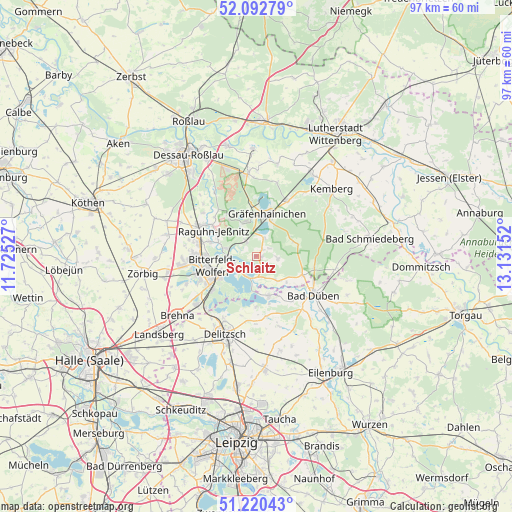
Schlaitz GPS coordinates[2]
51° 39' 31.356" North, 12° 25' 42.204" East
| Map corner | latitude | longitude |
|---|---|---|
| Upper-left | 52.09279°, | 11.72527° |
| Center: | 51.65871°, | 12.42839° |
| Lower-right: | 51.22043°, | 13.13152° |
| Map W x H: | 97×97 km | = 60.3×60.3mi |
| max Lat: | 55.01917° ⇑31.6% North |
| Schlaitz: | 51.65871° |
| min Lat: | ⇓68.4% South 47.40724° |
| min Long | Schlaitz | max Long |
| 5.92978° | 12.42839° | 14.98853° |
| W 87.3%⇐ | ⇒12.7% E |
Elevation
Elevation of Schlaitz is 99 m = 325 ft, and this is 150.1 m = 492 ft below average elevation for this country.
| Max E: |
1256 m = 4121 ft | 68.7% |
| Avg. | 249.1 m = 817 ft | |
| Schlaitz | 99 m = 325 ft | |
Min E: |
-5 m = -16 ft | 31.3% |
See also: Germany elevation on elevation.city.
Geographical zone
Schlaitz is located in North temperate zone (between Tropic of Cancer and the Arctic Circle). Distance of this North polar circle is 1657.3 km =1029.8 mi to North.| Distance of | km | miles | from Schlaitz |
|---|---|---|---|
| North Pole | 4263.2 | 2649 | to North |
| Arctic Circle | 1657.3 | 1029.8 | to North |
| Tropic Cancer | 3138 | 1949.9 | to South |
| Equator | 5743.9 | 3569.1 | to South |


Nearby cities:
15 places around Schlaitz: (largest is in red/bold)
• Bitterfeld-Wolfen
8.2 km =5.1 mi,  241°
241°
• Burgkemnitz
3.4 km =2.1 mi,  325°
325°
• Friedersdorf
4.5 km =2.8 mi,  254°
254°
• Gossa
1.6 km =1 mi,  42°
42°
• Greppin
8.9 km =5.5 mi,  261°
261°
• Gräfenhainichen
8 km =5 mi,  13°
13°
• Gröbern
3.7 km =2.3 mi,  25°
25°
• Krina
4.1 km =2.5 mi,  96°
96°
• Löbnitz
7.8 km =4.8 mi,  161°
161°
• Muldenstein
5.9 km =3.7 mi,  284°
284°
• Mühlbeck
4 km =2.5 mi, 235°
• Pouch
4.4 km =2.7 mi,  205°
205°
• Rösa
6.4 km =4 mi,  137°
137°
• Schköna
7.9 km =4.9 mi,  71°
71°
• Zschornewitz
6.6 km =4.1 mi,  342°
342°
Sources, notices
• [Note1] Compared only with cities in Germany existing in our database
• [Src1] Map data: © OpenStreetMap contributors (CC-BY-SA)
• [Src2] Other city data from geonames.org with taken over terms of usage.
• [Src3] Geographical zone / Annual Mean Temperature by Robert A. Rohde @ Wikipedia
