Sargstedt geodata
Sargstedt (Saxony-Anhalt) is a populated place; located in Germany in Europe/Berlin (GMT+2) time zone. With population of 766 people, there are 8025 cities with bigger population in this country. Compared to other cities in Germany, 71.5% of cities are located further ↓South; 66.8% of cities are located further ←West and 55.5% of cities have higher elevation than Sargstedt. Note1


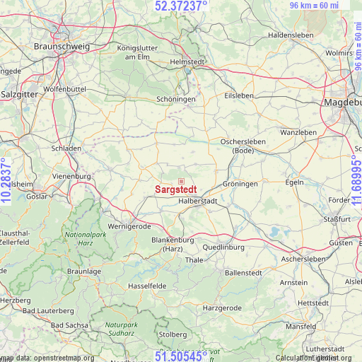
Sargstedt GPS coordinates[2]
51° 56' 27.6" North, 10° 59' 12.552" East
| Map corner | latitude | longitude |
|---|---|---|
| Upper-left | 52.37237°, | 10.2837° |
| Center: | 51.941°, | 10.98682° |
| Lower-right: | 51.50545°, | 11.68995° |
| Map W x H: | 96.4×96.4 km | = 59.9×59.9mi |
| max Lat: | 55.01917° ⇑28.5% North |
| Sargstedt: | 51.941° |
| min Lat: | ⇓71.5% South 47.40724° |
| min Long | Sargstedt | max Long |
| 5.92978° | 10.98682° | 14.98853° |
| W 66.8%⇐ | ⇒33.2% E |
Elevation
Elevation of Sargstedt is 185 m = 607 ft, and this is 64.1 m = 210 ft below average elevation for this country.
| Max E: |
1256 m = 4121 ft | 55.5% |
| Avg. | 249.1 m = 817 ft | |
| Sargstedt | 185 m = 607 ft | |
Min E: |
-5 m = -16 ft | 44.5% |
See also: Germany elevation on elevation.city.
Geographical zone
Sargstedt is located in North temperate zone (between Tropic of Cancer and the Arctic Circle). Distance of this North polar circle is 1625.9 km =1010.3 mi to North.| Distance of | km | miles | from Sargstedt |
|---|---|---|---|
| North Pole | 4231.8 | 2629.5 | to North |
| Arctic Circle | 1625.9 | 1010.3 | to North |
| Tropic Cancer | 3169.4 | 1969.4 | to South |
| Equator | 5775.3 | 3588.6 | to South |


Nearby cities:
15 places around Sargstedt: (largest is in red/bold)
• Aspenstedt
2.6 km =1.6 mi,  257°
257°
• Danstedt
7.6 km =4.7 mi,  244°
244°
• Derenburg
9.4 km =5.8 mi,  213°
213°
• Groß Quenstedt
8.9 km =5.5 mi,  95°
95°
• Halberstadt
6.9 km =4.3 mi,  136°
136°
• Harsleben
11.3 km =7 mi, 136°
• Heimburg
14.1 km =8.8 mi,  201°
201°
• Heudeber
10.7 km =6.6 mi,  246°
246°
• Huy-Neinstedt
5.7 km =3.5 mi,  299°
299°
• Langeln
13.6 km =8.5 mi, 256°
• Langenstein
9.5 km =5.9 mi,  179°
179°
• Schwanebeck
9.9 km =6.2 mi,  72°
72°
• Ströbeck
4.2 km =2.6 mi,  224°
224°
• Wegeleben
14.3 km =8.9 mi,  116°
116°
• Wulferstedt
13.2 km =8.2 mi,  48°
48°
Sources, notices
• [Note1] Compared only with cities in Germany existing in our database
• [Src1] Map data: © OpenStreetMap contributors (CC-BY-SA)
• [Src2] Other city data from geonames.org with taken over terms of usage.
• [Src3] Geographical zone / Annual Mean Temperature by Robert A. Rohde @ Wikipedia
