Halberstadt geodata
Halberstadt (Saxony-Anhalt) is a seat of a third-order administrative division; located in Germany in Europe/Berlin (GMT+2) time zone. With population of 39,729 people, there are 324 cities with bigger population in this country. Compared to other cities in Germany, 71.1% of cities are located further ↓South; 67.8% of cities are located further ←West and 64.6% of cities have higher elevation than Halberstadt. Note1


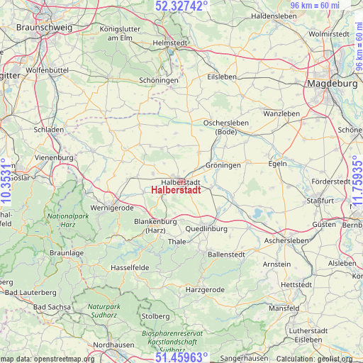
Halberstadt GPS coordinates[2]
51° 53' 44.232" North, 11° 3' 22.392" East
| Map corner | latitude | longitude |
|---|---|---|
| Upper-left | 52.32742°, | 10.3531° |
| Center: | 51.89562°, | 11.05622° |
| Lower-right: | 51.45963°, | 11.75935° |
| Map W x H: | 96.5×96.5 km | = 60×60mi |
| max Lat: | 55.01917° ⇑28.9% North |
| Halberstadt: | 51.89562° |
| min Lat: | ⇓71.1% South 47.40724° |
| min Long | Halberstadt | max Long |
| 5.92978° | 11.05622° | 14.98853° |
| W 67.8%⇐ | ⇒32.2% E |
Elevation
Elevation of Halberstadt is 123 m = 404 ft, and this is 126.1 m = 414 ft below average elevation for this country.
| Max E: |
1256 m = 4121 ft | 64.6% |
| Avg. | 249.1 m = 817 ft | |
| Halberstadt | 123 m = 404 ft | |
Min E: |
-5 m = -16 ft | 35.4% |
See also: Germany elevation on elevation.city.
Geographical zone
Halberstadt is located in North temperate zone (between Tropic of Cancer and the Arctic Circle). Distance of this North polar circle is 1630.9 km =1013.4 mi to North.| Distance of | km | miles | from Halberstadt |
|---|---|---|---|
| North Pole | 4236.8 | 2632.6 | to North |
| Arctic Circle | 1630.9 | 1013.4 | to North |
| Tropic Cancer | 3164.3 | 1966.2 | to South |
| Equator | 5770.3 | 3585.5 | to South |


Nearby cities:
15 places around Halberstadt: (largest is in red/bold)
• Aspenstedt
8.6 km =5.3 mi,  301°
301°
• Danstedt
11.8 km =7.3 mi,  278°
278°
• Derenburg
10.4 km =6.5 mi,  254°
254°
• Ditfurt
12.1 km =7.5 mi,  125°
125°
• Groß Quenstedt
5.9 km =3.7 mi,  44°
44°
• Gröningen
11.9 km =7.4 mi,  67°
67°
• Harsleben
4.4 km =2.7 mi,  136°
136°
• Heimburg
12.8 km =8 mi,  231°
231°
• Huy-Neinstedt
12.5 km =7.8 mi,  308°
308°
• Langenstein
6.5 km =4 mi, 226°
• Sargstedt
6.9 km =4.3 mi,  316°
316°
• Schwanebeck
9.3 km =5.8 mi,  30°
30°
• Ströbeck
7.9 km =4.9 mi, 284°
• Wegeleben
8.2 km =5.1 mi,  99°
99°
• Westerhausen
10 km =6.2 mi,  179°
179°
Sources, notices
• [Note1] Compared only with cities in Germany existing in our database
• [Src1] Map data: © OpenStreetMap contributors (CC-BY-SA)
• [Src2] Other city data from geonames.org with taken over terms of usage.
• [Src3] Geographical zone / Annual Mean Temperature by Robert A. Rohde @ Wikipedia
