Aspenstedt geodata
Aspenstedt (Saxony-Anhalt) is a populated place; located in Germany in Europe/Berlin (GMT+2) time zone. With population of 553 people, there are 9064 cities with bigger population in this country. Compared to other cities in Germany, 71.5% of cities are located further ↓South; 66.2% of cities are located further ←West and 55.4% of cities have higher elevation than Aspenstedt. Note1


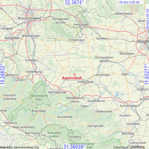
Aspenstedt GPS coordinates[2]
51° 56' 9.564" North, 10° 56' 58.704" East
| Map corner | latitude | longitude |
|---|---|---|
| Upper-left | 52.3674°, | 10.24652° |
| Center: | 51.93599°, | 10.94964° |
| Lower-right: | 51.50039°, | 11.65277° |
| Map W x H: | 96.4×96.4 km | = 59.9×59.9mi |
| max Lat: | 55.01917° ⇑28.5% North |
| Aspenstedt: | 51.93599° |
| min Lat: | ⇓71.5% South 47.40724° |
| min Long | Aspenstedt | max Long |
| 5.92978° | 10.94964° | 14.98853° |
| W 66.2%⇐ | ⇒33.8% E |
Elevation
Elevation of Aspenstedt is 186 m = 610 ft, and this is 63.1 m = 207 ft below average elevation for this country.
| Max E: |
1256 m = 4121 ft | 55.4% |
| Avg. | 249.1 m = 817 ft | |
| Aspenstedt | 186 m = 610 ft | |
Min E: |
-5 m = -16 ft | 44.6% |
See also: Germany elevation on elevation.city.
Geographical zone
Aspenstedt is located in North temperate zone (between Tropic of Cancer and the Arctic Circle). Distance of this North polar circle is 1626.4 km =1010.6 mi to North.| Distance of | km | miles | from Aspenstedt |
|---|---|---|---|
| North Pole | 4232.3 | 2629.8 | to North |
| Arctic Circle | 1626.4 | 1010.6 | to North |
| Tropic Cancer | 3168.8 | 1969 | to South |
| Equator | 5774.7 | 3588.2 | to South |


Nearby cities:
15 places around Aspenstedt: (largest is in red/bold)
• Danstedt
5.1 km =3.2 mi,  238°
238°
• Derenburg
7.7 km =4.8 mi,  200°
200°
• Groß Quenstedt
11.5 km =7.1 mi,  91°
91°
• Halberstadt
8.6 km =5.3 mi,  121°
121°
• Harsleben
12.9 km =8 mi,  126°
126°
• Heimburg
12.8 km =8 mi,  191°
191°
• Heudeber
8.2 km =5.1 mi, 242°
• Huy-Neinstedt
4.1 km =2.5 mi,  324°
324°
• Langeln
11 km =6.8 mi,  255°
255°
• Langenstein
9.3 km =5.8 mi,  163°
163°
• Reddeber
12.6 km =7.8 mi,  232°
232°
• Sargstedt
2.6 km =1.6 mi,  77°
77°
• Schwanebeck
12.5 km =7.8 mi,  73°
73°
• Ströbeck
2.5 km =1.6 mi, 188°
• Wasserleben
13.3 km =8.3 mi, 262°
Sources, notices
• [Note1] Compared only with cities in Germany existing in our database
• [Src1] Map data: © OpenStreetMap contributors (CC-BY-SA)
• [Src2] Other city data from geonames.org with taken over terms of usage.
• [Src3] Geographical zone / Annual Mean Temperature by Robert A. Rohde @ Wikipedia
