Rückersdorf geodata
Rückersdorf (Brandenburg) is a seat of a fourth-order administrative division; located in Germany in Europe/Berlin (GMT+2) time zone. With population of 1,773 people, there are 5394 cities with bigger population in this country. Compared to other cities in Germany, 67.1% of cities are located further ↓South; 96.2% of cities are located further ←West and 68.3% of cities have higher elevation than Rückersdorf. Note1
Administrative division(s):
- Level 1: Brandenburg
- Level 3: Landkreis Elbe-Elster
- Level 4: Rückersdorf


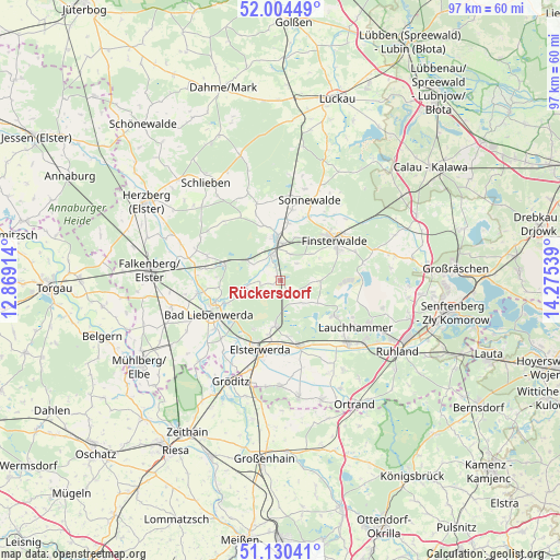
Rückersdorf GPS coordinates[2]
51° 34' 10.38" North, 13° 34' 20.136" East
| Map corner | latitude | longitude |
|---|---|---|
| Upper-left | 52.00449°, | 12.86914° |
| Center: | 51.56955°, | 13.57226° |
| Lower-right: | 51.13041°, | 14.27539° |
| Map W x H: | 97.2×97.2 km | = 60.4×60.4mi |
| max Lat: | 55.01917° ⇑32.9% North |
| Rückersdorf: | 51.56955° |
| min Lat: | ⇓67.1% South 47.40724° |
| min Long | Rückersdorf | max Long |
| 5.92978° | 13.57226° | 14.98853° |
| W 96.2%⇐ | ⇒3.8% E |
Elevation
Elevation of Rückersdorf is 101 m = 331 ft, and this is 148.1 m = 486 ft below average elevation for this country.
| Max E: |
1256 m = 4121 ft | 68.3% |
| Avg. | 249.1 m = 817 ft | |
| Rückersdorf | 101 m = 331 ft | |
Min E: |
-5 m = -16 ft | 31.7% |
See also: Germany elevation on elevation.city.
Geographical zone
Rückersdorf is located in North temperate zone (between Tropic of Cancer and the Arctic Circle). Distance of this North polar circle is 1667.2 km =1035.9 mi to North.| Distance of | km | miles | from Rückersdorf |
|---|---|---|---|
| North Pole | 4273.1 | 2655.2 | to North |
| Arctic Circle | 1667.2 | 1035.9 | to North |
| Tropic Cancer | 3128.1 | 1943.7 | to South |
| Equator | 5734 | 3562.9 | to South |


Nearby cities:
15 places around Rückersdorf: (largest is in red/bold)
• Bad Liebenwerda
13.5 km =8.4 mi,  245°
245°
• Doberlug-Kirchhain
6.3 km =3.9 mi,  353°
353°
• Elsterwerda
12.7 km =7.9 mi,  196°
196°
• Finsterwalde
11.7 km =7.3 mi,  52°
52°
• Hohenleipisch
7.9 km =4.9 mi,  191°
191°
• Lauchhammer
16.2 km =10.1 mi,  124°
124°
• Lichterfeld
14.6 km =9.1 mi,  77°
77°
• Plessa
11.8 km =7.3 mi,  164°
164°
• Schilda
13.5 km =8.4 mi,  284°
284°
• Schraden
18.1 km =11.2 mi,  152°
152°
• Schönborn
6.6 km =4.1 mi,  300°
300°
• Schönewalde
12.3 km =7.6 mi,  9°
9°
• Sonnewalde
14.6 km =9.1 mi,  20°
20°
• Tettau
18.8 km =11.7 mi,  143°
143°
• Tröbitz
10.2 km =6.3 mi,  289°
289°
Sources, notices
• [Note1] Compared only with cities in Germany existing in our database
• [Src1] Map data: © OpenStreetMap contributors (CC-BY-SA)
• [Src2] Other city data from geonames.org with taken over terms of usage.
• [Src3] Geographical zone / Annual Mean Temperature by Robert A. Rohde @ Wikipedia
