Rosenheim geodata
Rosenheim (Bavaria) is a seat of a third-order administrative division; located in Germany in Europe/Berlin (GMT+2) time zone. With population of 60,167 people, there are 172 cities with bigger population in this country. Compared to other cities in Germany, 97% of cities are located further ↑North; 83.5% of cities are located further ←West and 82.3% of cities have lower elevation than Rosenheim. Note1
Administrative division(s):
- Level 1: Bavaria
- Level 2: Upper Bavaria
- Level 3: Kreisfreie Stadt Rosenheim
- Level 4: Rosenheim


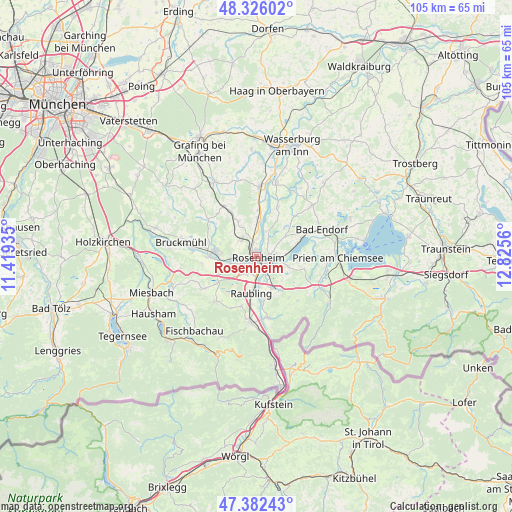
Rosenheim GPS coordinates[2]
47° 51' 22.932" North, 12° 7' 20.892" East
| Map corner | latitude | longitude |
|---|---|---|
| Upper-left | 48.32602°, | 11.41935° |
| Center: | 47.85637°, | 12.12247° |
| Lower-right: | 47.38243°, | 12.8256° |
| Map W x H: | 104.9×104.9 km | = 65.2×65.2mi |
| max Lat: | 55.01917° ⇑97% North |
| Rosenheim: | 47.85637° |
| min Lat: | ⇓3% South 47.40724° |
| min Long | Rosenheim | max Long |
| 5.92978° | 12.12247° | 14.98853° |
| W 83.5%⇐ | ⇒16.5% E |
Elevation
Elevation of Rosenheim is 448 m = 1470 ft, and this is 198.9 m = 653 ft above average elevation for this country.
| Max E: |
1256 m = 4121 ft | 17.7% |
| Rosenheim | 448 m 1470 ft | |
| Avg. | 249.1 m = 817 ft | |
Min E: |
-5 m = -16 ft | 82.3% |
See also: Rosenheim elevation on elevation.city.
Geographical zone
Rosenheim is located in North temperate zone (between Tropic of Cancer and the Arctic Circle). Distance of this North polar circle is 2080 km =1292.5 mi to North.| Distance of | km | miles | from Rosenheim |
|---|---|---|---|
| North Pole | 4685.9 | 2911.7 | to North |
| Arctic Circle | 2080 | 1292.5 | to North |
| Tropic Cancer | 2715.2 | 1687.1 | to South |
| Equator | 5321.1 | 3306.4 | to South |


Nearby cities:
15 places around Rosenheim: (largest is in red/bold)
• Altenmarkt
8.6 km =5.3 mi,  173°
173°
• Bad Aibling
8.4 km =5.2 mi,  275°
275°
• Großkarolinenfeld
4.9 km =3 mi,  321°
321°
• Kolbermoor
4.2 km =2.6 mi,  259°
259°
• Neubeuern
9.3 km =5.8 mi, 171°
• Prutting
7.2 km =4.5 mi,  55°
55°
• Raubling
7.4 km =4.6 mi,  186°
186°
• Riedering
6.7 km =4.2 mi,  107°
107°
• Rohrdorf
7.5 km =4.7 mi,  151°
151°
• Rott
7.5 km =4.7 mi,  339°
339°
• Samerberg
10.3 km =6.4 mi, 149°
• Schechen
8.1 km =5 mi,  0°
0°
• Stephanskirchen
4.7 km =2.9 mi,  93°
93°
• Söchtenau
11.5 km =7.1 mi,  43°
43°
• Vogtareuth
11 km =6.8 mi,  23°
23°
Sources, notices
• [Note1] Compared only with cities in Germany existing in our database
• [Src1] Map data: © OpenStreetMap contributors (CC-BY-SA)
• [Src2] Other city data from geonames.org with taken over terms of usage.
• [Src3] Geographical zone / Annual Mean Temperature by Robert A. Rohde @ Wikipedia
