Großkarolinenfeld geodata
Großkarolinenfeld (Bavaria) is a seat of a fourth-order administrative division; located in Germany in Europe/Berlin (GMT+2) time zone. With population of 6,865 people, there are 2214 cities with bigger population in this country. Compared to other cities in Germany, 96.8% of cities are located further ↑North; 82.9% of cities are located further ←West and 84.9% of cities have lower elevation than Großkarolinenfeld. Note1
Administrative division(s):
- Level 1: Bavaria
- Level 2: Upper Bavaria
- Level 3: Landkreis Rosenheim
- Level 4: Großkarolinenfeld


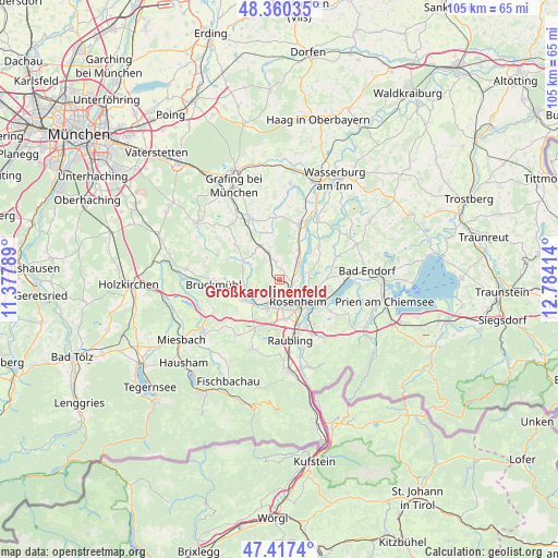
Großkarolinenfeld GPS coordinates[2]
47° 53' 27.672" North, 12° 4' 51.636" East
| Map corner | latitude | longitude |
|---|---|---|
| Upper-left | 48.36035°, | 11.37789° |
| Center: | 47.89102°, | 12.08101° |
| Lower-right: | 47.4174°, | 12.78414° |
| Map W x H: | 104.8×104.8 km | = 65.1×65.1mi |
| max Lat: | 55.01917° ⇑96.8% North |
| Großkarolinenfeld: | 47.89102° |
| min Lat: | ⇓3.2% South 47.40724° |
| min Long | Großkarolinenf | max Long |
| 5.92978° | 12.08101° | 14.98853° |
| W 82.9%⇐ | ⇒17.1% E |
Elevation
Elevation of Großkarolinenfeld is 468 m = 1535 ft, and this is 218.9 m = 718 ft above average elevation for this country.
| Max E: |
1256 m = 4121 ft | 15.1% |
| Großkarolinenfeld | 468 m 1535 ft | |
| Avg. | 249.1 m = 817 ft | |
Min E: |
-5 m = -16 ft | 84.9% |
See also: Germany elevation on elevation.city.
Geographical zone
Großkarolinenfeld is located in North temperate zone (between Tropic of Cancer and the Arctic Circle). Distance of this North polar circle is 2076.2 km =1290.1 mi to North.| Distance of | km | miles | from Großkarolinenfeld |
|---|---|---|---|
| North Pole | 4682.1 | 2909.3 | to North |
| Arctic Circle | 2076.2 | 1290.1 | to North |
| Tropic Cancer | 2719.1 | 1689.6 | to South |
| Equator | 5325 | 3308.8 | to South |


Nearby cities:
15 places around Großkarolinenfeld: (largest is in red/bold)
• Aßling
12.6 km =7.8 mi,  333°
333°
• Bad Aibling
6.1 km =3.8 mi,  240°
240°
• Emmering
12 km =7.5 mi,  351°
351°
• Kolbermoor
4.7 km =2.9 mi,  192°
192°
• Prutting
9.1 km =5.7 mi,  88°
88°
• Raubling
11.4 km =7.1 mi,  168°
168°
• Riedering
11.1 km =6.9 mi,  121°
121°
• Rohrdorf
12.4 km =7.7 mi,  147°
147°
• Rosenheim
4.9 km =3 mi,  141°
141°
• Rott
3.3 km =2.1 mi,  8°
8°
• Schechen
5.3 km =3.3 mi,  37°
37°
• Stephanskirchen
8.8 km =5.5 mi, 117°
• Söchtenau
11.9 km =7.4 mi,  68°
68°
• Tuntenhausen
6.9 km =4.3 mi,  314°
314°
• Vogtareuth
9.7 km =6 mi,  50°
50°
Sources, notices
• [Note1] Compared only with cities in Germany existing in our database
• [Src1] Map data: © OpenStreetMap contributors (CC-BY-SA)
• [Src2] Other city data from geonames.org with taken over terms of usage.
• [Src3] Geographical zone / Annual Mean Temperature by Robert A. Rohde @ Wikipedia
