Vogtareuth geodata
Vogtareuth (Bavaria) is a seat of a fourth-order administrative division; located in Germany in Europe/Berlin (GMT+2) time zone. With population of 3,045 people, there are 3967 cities with bigger population in this country. Compared to other cities in Germany, 96.1% of cities are located further ↑North; 84.4% of cities are located further ←West and 86.9% of cities have lower elevation than Vogtareuth. Note1
Administrative division(s):
- Level 1: Bavaria
- Level 2: Upper Bavaria
- Level 3: Landkreis Rosenheim
- Level 4: Vogtareuth


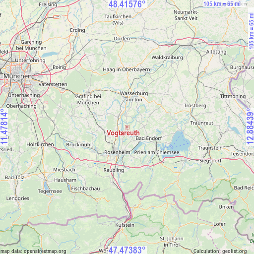
Vogtareuth GPS coordinates[2]
47° 56' 48.984" North, 12° 10' 52.536" East
| Map corner | latitude | longitude |
|---|---|---|
| Upper-left | 48.41576°, | 11.47814° |
| Center: | 47.94694°, | 12.18126° |
| Lower-right: | 47.47383°, | 12.88439° |
| Map W x H: | 104.7×104.7 km | = 65.1×65.1mi |
| max Lat: | 55.01917° ⇑96.1% North |
| Vogtareuth: | 47.94694° |
| min Lat: | ⇓3.9% South 47.40724° |
| min Long | Vogtareuth | max Long |
| 5.92978° | 12.18126° | 14.98853° |
| W 84.4%⇐ | ⇒15.6% E |
Elevation
Elevation of Vogtareuth is 485 m = 1591 ft, and this is 235.9 m = 774 ft above average elevation for this country.
| Max E: |
1256 m = 4121 ft | 13.1% |
| Vogtareuth | 485 m 1591 ft | |
| Avg. | 249.1 m = 817 ft | |
Min E: |
-5 m = -16 ft | 86.9% |
See also: Germany elevation on elevation.city.
Geographical zone
Vogtareuth is located in North temperate zone (between Tropic of Cancer and the Arctic Circle). Distance of this North polar circle is 2070 km =1286.2 mi to North.| Distance of | km | miles | from Vogtareuth |
|---|---|---|---|
| North Pole | 4675.9 | 2905.5 | to North |
| Arctic Circle | 2070 | 1286.2 | to North |
| Tropic Cancer | 2725.3 | 1693.4 | to South |
| Equator | 5331.2 | 3312.7 | to South |


Nearby cities:
15 places around Vogtareuth: (largest is in red/bold)
• Amerang
10.6 km =6.6 mi,  62°
62°
• Bad Endorf
9.7 km =6 mi,  115°
115°
• Breitbrunn
10.9 km =6.8 mi,  349°
349°
• Emmering
10.9 km =6.8 mi,  301°
301°
• Griesstätt
5.2 km =3.2 mi,  356°
356°
• Großkarolinenfeld
9.7 km =6 mi,  230°
230°
• Halfing
7 km =4.3 mi,  85°
85°
• Höslwang
11 km =6.8 mi, 86°
• Prutting
6.2 km =3.9 mi,  165°
165°
• Ramerberg
8.4 km =5.2 mi,  341°
341°
• Rott
7.6 km =4.7 mi,  246°
246°
• Schechen
4.7 km =2.9 mi, 245°
• Schonstett
6.5 km =4 mi,  51°
51°
• Stephanskirchen
10.4 km =6.5 mi,  178°
178°
• Söchtenau
4 km =2.5 mi, 115°
Sources, notices
• [Note1] Compared only with cities in Germany existing in our database
• [Src1] Map data: © OpenStreetMap contributors (CC-BY-SA)
• [Src2] Other city data from geonames.org with taken over terms of usage.
• [Src3] Geographical zone / Annual Mean Temperature by Robert A. Rohde @ Wikipedia
