Rimpar geodata
Rimpar (Bavaria) is a populated place; located in Germany in Europe/Berlin (GMT+2) time zone. With population of 7,718 people, there are 2005 cities with bigger population in this country. Compared to other cities in Germany, 67.6% of cities are located further ↑North; 50.7% of cities are located further →East and 51.1% of cities have lower elevation than Rimpar. Note1
Administrative division(s):
- Level 1: Bavaria
- Level 2: Regierungsbezirk Unterfranken
- Level 3: Landkreis Würzburg
- Level 4: Rimpar, Markt


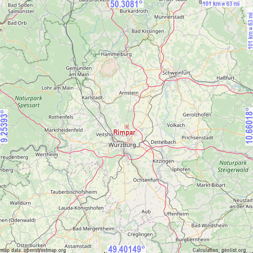
Rimpar GPS coordinates[2]
49° 51' 24.912" North, 9° 57' 25.38" East
| Map corner | latitude | longitude |
|---|---|---|
| Upper-left | 50.3081°, | 9.25393° |
| Center: | 49.85692°, | 9.95705° |
| Lower-right: | 49.40149°, | 10.66018° |
| Map W x H: | 100.8×100.8 km | = 62.6×62.6mi |
| max Lat: | 55.01917° ⇑67.6% North |
| Rimpar: | 49.85692° |
| min Lat: | ⇓32.4% South 47.40724° |
| min Long | Rimpar | max Long |
| 5.92978° | 9.95705° | 14.98853° |
| W 49.3%⇐ | ⇒50.7% E |
Elevation
Elevation of Rimpar is 234 m = 768 ft, and this is 15.1 m = 50 ft below average elevation for this country.
| Max E: |
1256 m = 4121 ft | 48.9% |
| Avg. | 249.1 m = 817 ft | |
| Rimpar | 234 m = 768 ft | |
Min E: |
-5 m = -16 ft | 51.1% |
See also: Germany elevation on elevation.city.
Geographical zone
Rimpar is located in North temperate zone (between Tropic of Cancer and the Arctic Circle). Distance of this North polar circle is 1857.6 km =1154.3 mi to North.| Distance of | km | miles | from Rimpar |
|---|---|---|---|
| North Pole | 4463.5 | 2773.5 | to North |
| Arctic Circle | 1857.6 | 1154.3 | to North |
| Tropic Cancer | 2937.7 | 1825.4 | to South |
| Equator | 5543.6 | 3444.6 | to South |


Nearby cities:
15 places around Rimpar: (largest is in red/bold)
• Bergtheim
9.2 km =5.7 mi,  58°
58°
• Erlabrunn
8.1 km =5 mi,  272°
272°
• Estenfeld
4.7 km =2.9 mi,  131°
131°
• Gadheim
3.9 km =2.4 mi,  251°
251°
• Gerbrunn
9.4 km =5.8 mi,  163°
163°
• Güntersleben
4 km =2.5 mi,  290°
290°
• Kürnach
5.5 km =3.4 mi,  98°
98°
• Margetshöchheim
7 km =4.3 mi, 252°
• Retzstadt
8.2 km =5.1 mi,  318°
318°
• Rottendorf
8.7 km =5.4 mi,  145°
145°
• Thüngersheim
8.1 km =5 mi, 287°
• Unterpleichfeld
6.4 km =4 mi,  77°
77°
• Veitshöchheim
6 km =3.7 mi,  243°
243°
• Würzburg
7 km =4.3 mi,  183°
183°
• Zell am Main
8 km =5 mi,  231°
231°
Sources, notices
• [Note1] Compared only with cities in Germany existing in our database
• [Src1] Map data: © OpenStreetMap contributors (CC-BY-SA)
• [Src2] Other city data from geonames.org with taken over terms of usage.
• [Src3] Geographical zone / Annual Mean Temperature by Robert A. Rohde @ Wikipedia
