Buchloe geodata
Buchloe (Bavaria) is a populated place; located in Germany in Europe/Berlin (GMT+2) time zone. With population of 11,978 people, there are 1372 cities with bigger population in this country. Compared to other cities in Germany, 95.1% of cities are located further ↑North; 62.9% of cities are located further ←West and 95.7% of cities have lower elevation than Buchloe. Note1
Administrative division(s):
- Level 1: Bavaria
- Level 2: Swabia
- Level 3: Landkreis Ostallgäu
- Level 4: Buchloe


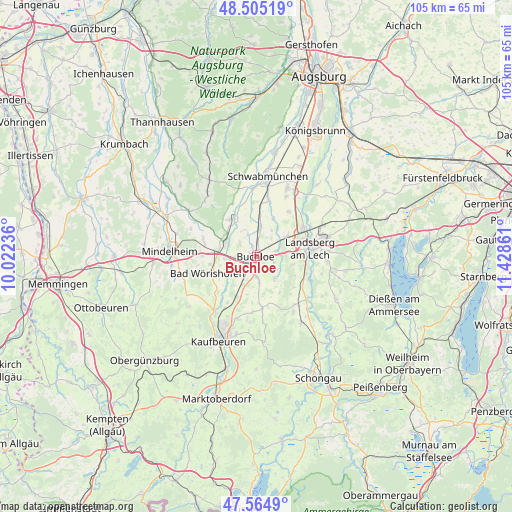
Buchloe GPS coordinates[2]
48° 2' 13.884" North, 10° 43' 31.728" East
| Map corner | latitude | longitude |
|---|---|---|
| Upper-left | 48.50519°, | 10.02236° |
| Center: | 48.03719°, | 10.72548° |
| Lower-right: | 47.5649°, | 11.42861° |
| Map W x H: | 104.6×104.5 km | = 65×64.9mi |
| max Lat: | 55.01917° ⇑95.1% North |
| Buchloe: | 48.03719° |
| min Lat: | ⇓4.9% South 47.40724° |
| min Long | Buchloe | max Long |
| 5.92978° | 10.72548° | 14.98853° |
| W 62.9%⇐ | ⇒37.1% E |
Elevation
Elevation of Buchloe is 615 m = 2018 ft, and this is 365.9 m = 1200 ft above average elevation for this country.
| Max E: |
1256 m = 4121 ft | 4.3% |
| Buchloe | 615 m 2018 ft | |
| Avg. | 249.1 m = 817 ft | |
Min E: |
-5 m = -16 ft | 95.7% |
See also: Germany elevation on elevation.city.
Geographical zone
Buchloe is located in North temperate zone (between Tropic of Cancer and the Arctic Circle). Distance of this North polar circle is 2059.9 km =1280 mi to North.| Distance of | km | miles | from Buchloe |
|---|---|---|---|
| North Pole | 4665.8 | 2899.2 | to North |
| Arctic Circle | 2059.9 | 1280 | to North |
| Tropic Cancer | 2735.3 | 1699.6 | to South |
| Equator | 5341.2 | 3318.9 | to South |


Nearby cities:
15 places around Buchloe: (largest is in red/bold)
• Amberg
4.5 km =2.8 mi,  316°
316°
• Bad Wörishofen
10.2 km =6.3 mi,  250°
250°
• Ettringen
9 km =5.6 mi, 321°
• Hurlach
11 km =6.8 mi,  35°
35°
• Jengen
4.2 km =2.6 mi,  179°
179°
• Lamerdingen
6.2 km =3.9 mi,  9°
9°
• Landsberg am Lech
11.8 km =7.3 mi,  84°
84°
• Langerringen
12.3 km =7.6 mi, 11°
• Oberostendorf
10.5 km =6.5 mi,  172°
172°
• Rieden
11.2 km =7 mi,  210°
210°
• Türkheim
6.9 km =4.3 mi,  295°
295°
• Unterdießen
10 km =6.2 mi,  126°
126°
• Waal
5.9 km =3.7 mi,  139°
139°
• Westendorf
11.6 km =7.2 mi, 183°
• Wiedergeltingen
3.8 km =2.4 mi,  273°
273°
Sources, notices
• [Note1] Compared only with cities in Germany existing in our database
• [Src1] Map data: © OpenStreetMap contributors (CC-BY-SA)
• [Src2] Other city data from geonames.org with taken over terms of usage.
• [Src3] Geographical zone / Annual Mean Temperature by Robert A. Rohde @ Wikipedia
