Frankenfeld geodata
Frankenfeld (Lower Saxony) is a seat of a fourth-order administrative division; located in Germany in Europe/Berlin (GMT+2) time zone. With population of 563 people, there are 9012 cities with bigger population in this country. Compared to other cities in Germany, 80.2% of cities are located further ↓South; 58.9% of cities are located further →East and 90.1% of cities have higher elevation than Frankenfeld. Note1
Administrative division(s):
- Level 1: Lower Saxony
- Level 3: Landkreis Heidekreis
- Level 4: Frankenfeld


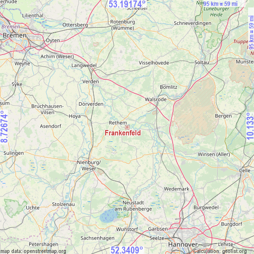
Frankenfeld GPS coordinates[2]
52° 46' 6.24" North, 9° 25' 47.532" East
| Map corner | latitude | longitude |
|---|---|---|
| Upper-left | 53.19174°, | 8.72674° |
| Center: | 52.7684°, | 9.42987° |
| Lower-right: | 52.3409°, | 10.133° |
| Map W x H: | 94.6×94.6 km | = 58.8×58.8mi |
| max Lat: | 55.01917° ⇑19.8% North |
| Frankenfeld: | 52.7684° |
| min Lat: | ⇓80.2% South 47.40724° |
| min Long | Frankenfeld | max Long |
| 5.92978° | 9.42987° | 14.98853° |
| W 41.1%⇐ | ⇒58.9% E |
Elevation
Elevation of Frankenfeld is 21 m = 69 ft, and this is 228.1 m = 748 ft below average elevation for this country.
| Max E: |
1256 m = 4121 ft | 90.1% |
| Avg. | 249.1 m = 817 ft | |
| Frankenfeld | 21 m = 69 ft | |
Min E: |
-5 m = -16 ft | 9.9% |
See also: Germany elevation on elevation.city.
Geographical zone
Frankenfeld is located in North temperate zone (between Tropic of Cancer and the Arctic Circle). Distance of this North polar circle is 1533.9 km =953.1 mi to North.| Distance of | km | miles | from Frankenfeld |
|---|---|---|---|
| North Pole | 4139.8 | 2572.4 | to North |
| Arctic Circle | 1533.9 | 953.1 | to North |
| Tropic Cancer | 3261.4 | 2026.5 | to South |
| Equator | 5867.3 | 3645.8 | to South |


Nearby cities:
15 places around Frankenfeld: (largest is in red/bold)
• Ahlden
8.2 km =5.1 mi,  96°
96°
• Böhme
3 km =1.9 mi,  56°
56°
• Eickeloh
12.7 km =7.9 mi,  110°
110°
• Eystrup
14.6 km =9.1 mi,  274°
274°
• Gandesbergen
13.8 km =8.6 mi, 266°
• Gilten
12.8 km =8 mi,  126°
126°
• Grethem
10.6 km =6.6 mi,  115°
115°
• Haßbergen
13.8 km =8.6 mi,  253°
253°
• Heemsen
13.4 km =8.3 mi,  235°
235°
• Hodenhagen
11.1 km =6.9 mi,  91°
91°
• Hämelhausen
10 km =6.2 mi,  277°
277°
• Häuslingen
5.3 km =3.3 mi,  331°
331°
• Rethem
4 km =2.5 mi,  299°
299°
• Röhrsen
14.8 km =9.2 mi, 244°
• Steimbke
12.9 km =8 mi,  191°
191°
Sources, notices
• [Note1] Compared only with cities in Germany existing in our database
• [Src1] Map data: © OpenStreetMap contributors (CC-BY-SA)
• [Src2] Other city data from geonames.org with taken over terms of usage.
• [Src3] Geographical zone / Annual Mean Temperature by Robert A. Rohde @ Wikipedia
