Ahlden geodata
Ahlden (Lower Saxony) is a populated place; located in Germany in Europe/Berlin (GMT+2) time zone. With population of 1,573 people, there are 5737 cities with bigger population in this country. Compared to other cities in Germany, 80.1% of cities are located further ↓South; 57% of cities are located further →East and 88.6% of cities have higher elevation than Ahlden. Note1
Administrative division(s):
- Level 1: Lower Saxony
- Level 3: Landkreis Heidekreis
- Level 4: Ahlden (Aller), Flecken


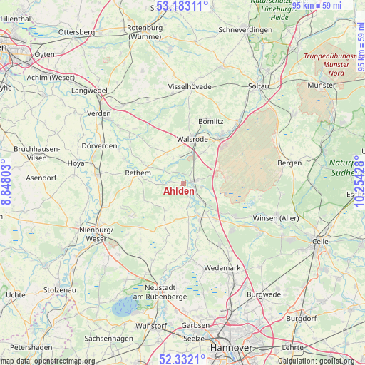
Ahlden GPS coordinates[2]
52° 45' 34.848" North, 9° 33' 4.14" East
| Map corner | latitude | longitude |
|---|---|---|
| Upper-left | 53.18311°, | 8.84803° |
| Center: | 52.75968°, | 9.55115° |
| Lower-right: | 52.3321°, | 10.25428° |
| Map W x H: | 94.6×94.6 km | = 58.8×58.8mi |
| max Lat: | 55.01917° ⇑19.9% North |
| Ahlden: | 52.75968° |
| min Lat: | ⇓80.1% South 47.40724° |
| min Long | Ahlden | max Long |
| 5.92978° | 9.55115° | 14.98853° |
| W 43%⇐ | ⇒57% E |
Elevation
Elevation of Ahlden is 25 m = 82 ft, and this is 224.1 m = 735 ft below average elevation for this country.
| Max E: |
1256 m = 4121 ft | 88.6% |
| Avg. | 249.1 m = 817 ft | |
| Ahlden | 25 m = 82 ft | |
Min E: |
-5 m = -16 ft | 11.4% |
See also: Germany elevation on elevation.city.
Geographical zone
Ahlden is located in North temperate zone (between Tropic of Cancer and the Arctic Circle). Distance of this North polar circle is 1534.8 km =953.7 mi to North.| Distance of | km | miles | from Ahlden |
|---|---|---|---|
| North Pole | 4140.7 | 2572.9 | to North |
| Arctic Circle | 1534.8 | 953.7 | to North |
| Tropic Cancer | 3260.4 | 2025.9 | to South |
| Equator | 5866.3 | 3645.1 | to South |


Nearby cities:
15 places around Ahlden: (largest is in red/bold)
• Bad Fallingbostel
15.3 km =9.5 mi,  39°
39°
• Bomlitz
17 km =10.6 mi,  23°
23°
• Böhme
6.3 km =3.9 mi,  294°
294°
• Eickeloh
5.1 km =3.2 mi,  132°
132°
• Essel
9.7 km =6 mi,  141°
141°
• Frankenfeld
8.2 km =5.1 mi,  276°
276°
• Gilten
7 km =4.3 mi,  161°
161°
• Grethem
3.9 km =2.4 mi, 158°
• Hademstorf
7.4 km =4.6 mi, 133°
• Hodenhagen
3 km =1.9 mi,  78°
78°
• Häuslingen
12.1 km =7.5 mi,  297°
297°
• Rethem
12 km =7.5 mi, 284°
• Schwarmstedt
10.1 km =6.3 mi,  153°
153°
• Steimbke
15.9 km =9.9 mi,  222°
222°
• Walsrode
11.7 km =7.3 mi,  13°
13°
Sources, notices
• [Note1] Compared only with cities in Germany existing in our database
• [Src1] Map data: © OpenStreetMap contributors (CC-BY-SA)
• [Src2] Other city data from geonames.org with taken over terms of usage.
• [Src3] Geographical zone / Annual Mean Temperature by Robert A. Rohde @ Wikipedia
