Hanstedt Eins geodata
Hanstedt Eins (Lower Saxony) is a populated place; located in Germany in Europe/Berlin (GMT+2) time zone. With population of 1,004 people, there are 7165 cities with bigger population in this country. Compared to other cities in Germany, 82% of cities are located further ↓South; 56.8% of cities are located further ←West and 74.3% of cities have higher elevation than Hanstedt Eins. Note1


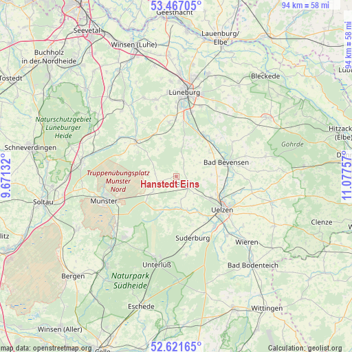
Hanstedt Eins GPS coordinates[2]
53° 2' 47.112" North, 10° 22' 27.984" East
| Map corner | latitude | longitude |
|---|---|---|
| Upper-left | 53.46705°, | 9.67132° |
| Center: | 53.04642°, | 10.37444° |
| Lower-right: | 52.62165°, | 11.07757° |
| Map W x H: | 94×94 km | = 58.4×58.4mi |
| max Lat: | 55.01917° ⇑18% North |
| Hanstedt Eins: | 53.04642° |
| min Lat: | ⇓82% South 47.40724° |
| min Long | Hanstedt Eins | max Long |
| 5.92978° | 10.37444° | 14.98853° |
| W 56.8%⇐ | ⇒43.2% E |
Elevation
Elevation of Hanstedt Eins is 66 m = 217 ft, and this is 183.1 m = 601 ft below average elevation for this country.
| Max E: |
1256 m = 4121 ft | 74.3% |
| Avg. | 249.1 m = 817 ft | |
| Hanstedt Eins | 66 m = 217 ft | |
Min E: |
-5 m = -16 ft | 25.7% |
See also: Germany elevation on elevation.city.
Geographical zone
Hanstedt Eins is located in North temperate zone (between Tropic of Cancer and the Arctic Circle). Distance of this North polar circle is 1503 km =933.9 mi to North.| Distance of | km | miles | from Hanstedt Eins |
|---|---|---|---|
| North Pole | 4108.9 | 2553.2 | to North |
| Arctic Circle | 1503 | 933.9 | to North |
| Tropic Cancer | 3292.3 | 2045.7 | to South |
| Equator | 5898.2 | 3665 | to South |


Nearby cities:
15 places around Hanstedt Eins: (largest is in red/bold)
• Amelinghausen
13.8 km =8.6 mi,  308°
308°
• Bad Bevensen
14.3 km =8.9 mi,  75°
75°
• Barnstedt
9.7 km =6 mi,  356°
356°
• Barum
9.5 km =5.9 mi,  87°
87°
• Betzendorf
10.9 km =6.8 mi,  337°
337°
• Bienenbüttel
13 km =8.1 mi,  35°
35°
• Ebstorf
3.6 km =2.2 mi,  125°
125°
• Eimke
9.8 km =6.1 mi,  204°
204°
• Emmendorf
13 km =8.1 mi,  102°
102°
• Gerdau
9.3 km =5.8 mi,  162°
162°
• Jelmstorf
11.6 km =7.2 mi,  58°
58°
• Natendorf
7.4 km =4.6 mi, 59°
• Rehlingen
12.2 km =7.6 mi,  302°
302°
• Schwienau
6.6 km =4.1 mi, 133°
• Wriedel
5.3 km =3.3 mi,  251°
251°
Sources, notices
• [Note1] Compared only with cities in Germany existing in our database
• [Src1] Map data: © OpenStreetMap contributors (CC-BY-SA)
• [Src2] Other city data from geonames.org with taken over terms of usage.
• [Src3] Geographical zone / Annual Mean Temperature by Robert A. Rohde @ Wikipedia
