Rehling geodata
Rehling (Bavaria) is a seat of a fourth-order administrative division; located in Germany in Europe/Berlin (GMT+2) time zone. With population of 2,381 people, there are 4575 cities with bigger population in this country. Compared to other cities in Germany, 89.3% of cities are located further ↑North; 66% of cities are located further ←West and 88.8% of cities have lower elevation than Rehling. Note1
Administrative division(s):
- Level 1: Bavaria
- Level 2: Swabia
- Level 3: Landkreis Aichach-Friedberg
- Level 4: Rehling


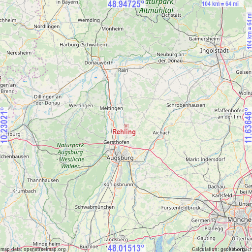
Rehling GPS coordinates[2]
48° 28' 59.988" North, 10° 55' 59.988" East
| Map corner | latitude | longitude |
|---|---|---|
| Upper-left | 48.94725°, | 10.23021° |
| Center: | 48.48333°, | 10.93333° |
| Lower-right: | 48.01513°, | 11.63646° |
| Map W x H: | 103.6×103.6 km | = 64.4×64.4mi |
| max Lat: | 55.01917° ⇑89.3% North |
| Rehling: | 48.48333° |
| min Lat: | ⇓10.7% South 47.40724° |
| min Long | Rehling | max Long |
| 5.92978° | 10.93333° | 14.98853° |
| W 66%⇐ | ⇒34% E |
Elevation
Elevation of Rehling is 502 m = 1647 ft, and this is 252.9 m = 830 ft above average elevation for this country.
| Max E: |
1256 m = 4121 ft | 11.2% |
| Rehling | 502 m 1647 ft | |
| Avg. | 249.1 m = 817 ft | |
Min E: |
-5 m = -16 ft | 88.8% |
See also: Germany elevation on elevation.city.
Geographical zone
Rehling is located in North temperate zone (between Tropic of Cancer and the Arctic Circle). Distance of this North polar circle is 2010.3 km =1249.1 mi to North.| Distance of | km | miles | from Rehling |
|---|---|---|---|
| North Pole | 4616.2 | 2868.4 | to North |
| Arctic Circle | 2010.3 | 1249.1 | to North |
| Tropic Cancer | 2784.9 | 1730.5 | to South |
| Equator | 5390.8 | 3349.7 | to South |


Nearby cities:
15 places around Rehling: (largest is in red/bold)
• Affing
4.1 km =2.5 mi,  116°
116°
• Aindling
3.7 km =2.3 mi,  23°
23°
• Augsburg
12.7 km =7.9 mi,  191°
191°
• Biberbach
9.8 km =6.1 mi,  293°
293°
• Gablingen
9.4 km =5.8 mi,  246°
246°
• Gersthofen
7.9 km =4.9 mi,  214°
214°
• Hollenbach
9.8 km =6.1 mi,  90°
90°
• Kühlenthal
12.6 km =7.8 mi,  317°
317°
• Langweid
6 km =3.7 mi,  278°
278°
• Meitingen
9.2 km =5.7 mi, 319°
• Obergriesbach
12 km =7.5 mi, 123°
• Petersdorf
8.2 km =5.1 mi,  63°
63°
• Thierhaupten
9.3 km =5.8 mi,  348°
348°
• Todtenweis
3.8 km =2.4 mi, 354°
• Westendorf
12 km =7.5 mi,  325°
325°
Sources, notices
• [Note1] Compared only with cities in Germany existing in our database
• [Src1] Map data: © OpenStreetMap contributors (CC-BY-SA)
• [Src2] Other city data from geonames.org with taken over terms of usage.
• [Src3] Geographical zone / Annual Mean Temperature by Robert A. Rohde @ Wikipedia
