Roggenburg geodata
Roggenburg (Bavaria) is a seat of a fourth-order administrative division; located in Germany in Europe/Berlin (GMT+2) time zone. With population of 2,642 people, there are 4291 cities with bigger population in this country. Compared to other cities in Germany, 91.6% of cities are located further ↑North; 53.9% of cities are located further ←West and 92.7% of cities have lower elevation than Roggenburg. Note1
Administrative division(s):
- Level 1: Bavaria
- Level 2: Swabia
- Level 3: Landkreis Neu-Ulm
- Level 4: Roggenburg


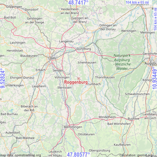
Roggenburg GPS coordinates[2]
48° 16' 33.168" North, 10° 13' 52.896" East
| Map corner | latitude | longitude |
|---|---|---|
| Upper-left | 48.7417°, | 9.52824° |
| Center: | 48.27588°, | 10.23136° |
| Lower-right: | 47.80577°, | 10.93449° |
| Map W x H: | 104.1×104.1 km | = 64.7×64.7mi |
| max Lat: | 55.01917° ⇑91.6% North |
| Roggenburg: | 48.27588° |
| min Lat: | ⇓8.4% South 47.40724° |
| min Long | Roggenburg | max Long |
| 5.92978° | 10.23136° | 14.98853° |
| W 53.9%⇐ | ⇒46.1% E |
Elevation
Elevation of Roggenburg is 553 m = 1814 ft, and this is 303.9 m = 997 ft above average elevation for this country.
| Max E: |
1256 m = 4121 ft | 7.3% |
| Roggenburg | 553 m 1814 ft | |
| Avg. | 249.1 m = 817 ft | |
Min E: |
-5 m = -16 ft | 92.7% |
See also: Germany elevation on elevation.city.
Geographical zone
Roggenburg is located in North temperate zone (between Tropic of Cancer and the Arctic Circle). Distance of this North polar circle is 2033.4 km =1263.5 mi to North.| Distance of | km | miles | from Roggenburg |
|---|---|---|---|
| North Pole | 4639.3 | 2882.7 | to North |
| Arctic Circle | 2033.4 | 1263.5 | to North |
| Tropic Cancer | 2761.9 | 1716.2 | to South |
| Equator | 5367.8 | 3335.4 | to South |


Nearby cities:
15 places around Roggenburg: (largest is in red/bold)
• Bellenberg
10.6 km =6.6 mi,  258°
258°
• Breitenthal
6.6 km =4.1 mi,  129°
129°
• Buch
6.8 km =4.2 mi,  213°
213°
• Deisenhausen
7.4 km =4.6 mi,  107°
107°
• Ebershausen
10 km =6.2 mi,  141°
141°
• Ellzee
9.6 km =6 mi,  42°
42°
• Illertissen
11.1 km =6.9 mi,  238°
238°
• Kettershausen
10.6 km =6.6 mi,  165°
165°
• Krumbach
10.5 km =6.5 mi, 111°
• Oberroth
11.6 km =7.2 mi,  195°
195°
• Pfaffenhofen an der Roth
10.1 km =6.3 mi,  329°
329°
• Unterroth
10 km =6.2 mi, 206°
• Vöhringen
11 km =6.8 mi,  271°
271°
• Waldstetten
9.3 km =5.8 mi,  29°
29°
• Weißenhorn
6.2 km =3.9 mi,  301°
301°
Sources, notices
• [Note1] Compared only with cities in Germany existing in our database
• [Src1] Map data: © OpenStreetMap contributors (CC-BY-SA)
• [Src2] Other city data from geonames.org with taken over terms of usage.
• [Src3] Geographical zone / Annual Mean Temperature by Robert A. Rohde @ Wikipedia
