Otterstadt geodata
Otterstadt (Rheinland-Pfalz) is a seat of a fourth-order administrative division; located in Germany in Europe/Berlin (GMT+2) time zone. With population of 3,282 people, there are 3766 cities with bigger population in this country. Compared to other cities in Germany, 77.6% of cities are located further ↑North; 71.6% of cities are located further →East and 68.7% of cities have higher elevation than Otterstadt. Note1


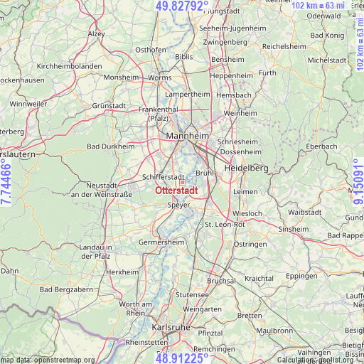
Otterstadt GPS coordinates[2]
49° 22' 19.992" North, 8° 26' 52.008" East
| Map corner | latitude | longitude |
|---|---|---|
| Upper-left | 49.82792°, | 7.74466° |
| Center: | 49.37222°, | 8.44778° |
| Lower-right: | 48.91225°, | 9.15091° |
| Map W x H: | 101.8×101.8 km | = 63.3×63.3mi |
| max Lat: | 55.01917° ⇑77.6% North |
| Otterstadt: | 49.37222° |
| min Lat: | ⇓22.4% South 47.40724° |
| min Long | Otterstadt | max Long |
| 5.92978° | 8.44778° | 14.98853° |
| W 28.4%⇐ | ⇒71.6% E |
Elevation
Elevation of Otterstadt is 99 m = 325 ft, and this is 150.1 m = 492 ft below average elevation for this country.
| Max E: |
1256 m = 4121 ft | 68.7% |
| Avg. | 249.1 m = 817 ft | |
| Otterstadt | 99 m = 325 ft | |
Min E: |
-5 m = -16 ft | 31.3% |
See also: Germany elevation on elevation.city.
Geographical zone
Otterstadt is located in North temperate zone (between Tropic of Cancer and the Arctic Circle). Distance of this North polar circle is 1911.5 km =1187.8 mi to North.| Distance of | km | miles | from Otterstadt |
|---|---|---|---|
| North Pole | 4517.4 | 2807 | to North |
| Arctic Circle | 1911.5 | 1187.8 | to North |
| Tropic Cancer | 2883.8 | 1791.9 | to South |
| Equator | 5489.7 | 3411.1 | to South |


Nearby cities:
15 places around Otterstadt: (largest is in red/bold)
• Altlußheim
8.7 km =5.4 mi,  154°
154°
• Altrip
7.8 km =4.8 mi,  25°
25°
• Brühl
6.8 km =4.2 mi,  65°
65°
• Dudenhofen
7.3 km =4.5 mi,  215°
215°
• Hanhofen
9.9 km =6.2 mi,  231°
231°
• Hockenheim
9.3 km =5.8 mi,  125°
125°
• Ketsch
6.1 km =3.8 mi,  94°
94°
• Limburgerhof
7.1 km =4.4 mi,  325°
325°
• Neuhofen
6.4 km =4 mi,  344°
344°
• Neulußheim
9.7 km =6 mi, 148°
• Oftersheim
9.8 km =6.1 mi, 94°
• Schifferstadt
5.3 km =3.3 mi,  284°
284°
• Schwetzingen
9.8 km =6.1 mi,  83°
83°
• Speyer
5.8 km =3.6 mi,  191°
191°
• Waldsee
2.6 km =1.6 mi,  348°
348°
Sources, notices
• [Note1] Compared only with cities in Germany existing in our database
• [Src1] Map data: © OpenStreetMap contributors (CC-BY-SA)
• [Src2] Other city data from geonames.org with taken over terms of usage.
• [Src3] Geographical zone / Annual Mean Temperature by Robert A. Rohde @ Wikipedia
