Dudenhofen geodata
Dudenhofen (Rheinland-Pfalz) is a seat of a fourth-order administrative division; located in Germany in Europe/Berlin (GMT+2) time zone. With population of 5,709 people, there are 2560 cities with bigger population in this country. Compared to other cities in Germany, 78.3% of cities are located further ↑North; 72.1% of cities are located further →East and 67.4% of cities have higher elevation than Dudenhofen. Note1


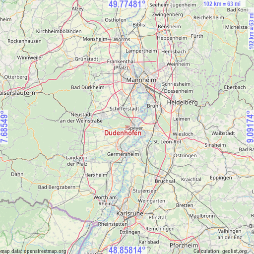
Dudenhofen GPS coordinates[2]
49° 19' 6.996" North, 8° 23' 18.996" East
| Map corner | latitude | longitude |
|---|---|---|
| Upper-left | 49.77481°, | 7.68549° |
| Center: | 49.31861°, | 8.38861° |
| Lower-right: | 48.85814°, | 9.09174° |
| Map W x H: | 101.9×101.9 km | = 63.3×63.3mi |
| max Lat: | 55.01917° ⇑78.3% North |
| Dudenhofen: | 49.31861° |
| min Lat: | ⇓21.7% South 47.40724° |
| min Long | Dudenhofen | max Long |
| 5.92978° | 8.38861° | 14.98853° |
| W 27.9%⇐ | ⇒72.1% E |
Elevation
Elevation of Dudenhofen is 105 m = 344 ft, and this is 144.1 m = 473 ft below average elevation for this country.
| Max E: |
1256 m = 4121 ft | 67.4% |
| Avg. | 249.1 m = 817 ft | |
| Dudenhofen | 105 m = 344 ft | |
Min E: |
-5 m = -16 ft | 32.6% |
See also: Germany elevation on elevation.city.
Geographical zone
Dudenhofen is located in North temperate zone (between Tropic of Cancer and the Arctic Circle). Distance of this North polar circle is 1917.5 km =1191.5 mi to North.| Distance of | km | miles | from Dudenhofen |
|---|---|---|---|
| North Pole | 4523.3 | 2810.6 | to North |
| Arctic Circle | 1917.5 | 1191.5 | to North |
| Tropic Cancer | 2877.8 | 1788.2 | to South |
| Equator | 5483.7 | 3407.4 | to South |


Nearby cities:
15 places around Dudenhofen: (largest is in red/bold)
• Altlußheim
8.2 km =5.1 mi,  103°
103°
• Böhl-Iggelheim
9.2 km =5.7 mi,  318°
318°
• Gommersheim
9.4 km =5.8 mi,  251°
251°
• Hanhofen
3.5 km =2.2 mi,  266°
266°
• Harthausen
4.2 km =2.6 mi,  229°
229°
• Lingenfeld
8.1 km =5 mi,  206°
206°
• Neulußheim
9.7 km =6 mi, 103°
• Oberhausen-Rheinhausen
7.8 km =4.8 mi,  129°
129°
• Otterstadt
7.3 km =4.5 mi,  35°
35°
• Schifferstadt
7.3 km =4.5 mi,  353°
353°
• Schwegenheim
6.9 km =4.3 mi,  218°
218°
• Speyer
3.1 km =1.9 mi,  85°
85°
• Waldsee
9.3 km =5.8 mi,  23°
23°
• Weingarten
9.9 km =6.2 mi, 228°
• Westheim
9.3 km =5.8 mi, 210°
Sources, notices
• [Note1] Compared only with cities in Germany existing in our database
• [Src1] Map data: © OpenStreetMap contributors (CC-BY-SA)
• [Src2] Other city data from geonames.org with taken over terms of usage.
• [Src3] Geographical zone / Annual Mean Temperature by Robert A. Rohde @ Wikipedia
