Nienburg geodata
Nienburg (Lower Saxony) is a seat of a third-order administrative division; located in Germany in Europe/Berlin (GMT+2) time zone. With population of 32,629 people, there are 419 cities with bigger population in this country. Compared to other cities in Germany, 79.3% of cities are located further ↓South; 62% of cities are located further →East and 87.7% of cities have higher elevation than Nienburg. Note1
Administrative division(s):
- Level 1: Lower Saxony
- Level 3: Landkreis Nienburg/Weser
- Level 4: Nienburg/Weser


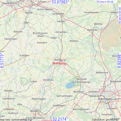
Nienburg GPS coordinates[2]
52° 38' 45.96" North, 9° 13' 15.096" East
| Map corner | latitude | longitude |
|---|---|---|
| Upper-left | 53.07063°, | 8.51773° |
| Center: | 52.6461°, | 9.22086° |
| Lower-right: | 52.2174°, | 9.92398° |
| Map W x H: | 94.9×94.9 km | = 59×59mi |
| max Lat: | 55.01917° ⇑20.7% North |
| Nienburg: | 52.6461° |
| min Lat: | ⇓79.3% South 47.40724° |
| min Long | Nienburg | max Long |
| 5.92978° | 9.22086° | 14.98853° |
| W 38%⇐ | ⇒62% E |
Elevation
Elevation of Nienburg is 28 m = 92 ft, and this is 221.1 m = 725 ft below average elevation for this country.
| Max E: |
1256 m = 4121 ft | 87.7% |
| Avg. | 249.1 m = 817 ft | |
| Nienburg | 28 m = 92 ft | |
Min E: |
-5 m = -16 ft | 12.3% |
See also: Germany elevation on elevation.city.
Geographical zone
Nienburg is located in North temperate zone (between Tropic of Cancer and the Arctic Circle). Distance of this North polar circle is 1547.5 km =961.6 mi to North.| Distance of | km | miles | from Nienburg |
|---|---|---|---|
| North Pole | 4153.4 | 2580.8 | to North |
| Arctic Circle | 1547.5 | 961.6 | to North |
| Tropic Cancer | 3247.8 | 2018.1 | to South |
| Equator | 5853.7 | 3637.3 | to South |


Nearby cities:
15 places around Nienburg: (largest is in red/bold)
• Balge
8.7 km =5.4 mi,  335°
335°
• Binnen
6.8 km =4.2 mi,  241°
241°
• Drakenburg
4.6 km =2.9 mi,  351°
351°
• Estorf
8.4 km =5.2 mi,  219°
219°
• Haßbergen
9.7 km =6 mi,  4°
4°
• Heemsen
6.7 km =4.2 mi,  27°
27°
• Husum
9 km =5.6 mi,  167°
167°
• Landesbergen
11.9 km =7.4 mi,  212°
212°
• Liebenau
9.6 km =6 mi, 240°
• Linsburg
8 km =5 mi,  136°
136°
• Marklohe
5.9 km =3.7 mi,  295°
295°
• Röhrsen
7.2 km =4.5 mi,  5°
5°
• Schweringen
11.8 km =7.3 mi, 347°
• Steimbke
11.5 km =7.1 mi,  85°
85°
• Stöckse
8.1 km =5 mi, 94°
In other languages:
- In France: Nienburg/Weser
- In German: Nienburg/Weser
- In Russian: Нинбург
- In Chinese: 宁布尔格
Sources, notices
• [Note1] Compared only with cities in Germany existing in our database
• [Src1] Map data: © OpenStreetMap contributors (CC-BY-SA)
• [Src2] Other city data from geonames.org with taken over terms of usage.
• [Src3] Geographical zone / Annual Mean Temperature by Robert A. Rohde @ Wikipedia
