Nettetal geodata
Nettetal (North Rhine-Westphalia) is a seat of a fourth-order administrative division; located in Germany in Europe/Berlin (GMT+2) time zone. With population of 42,417 people, there are 295 cities with bigger population in this country. Compared to other cities in Germany, 63.5% of cities are located further ↓South; 99.3% of cities are located further →East and 78.3% of cities have higher elevation than Nettetal. Note1
Administrative division(s):
- Level 1: North Rhine-Westphalia
- Level 2: Düsseldorf District
- Level 3: Kreis Viersen
- Level 4: Nettetal


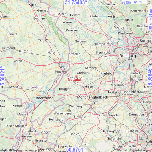
Nettetal GPS coordinates[2]
51° 19' 0.012" North, 6° 16' 59.988" East
| Map corner | latitude | longitude |
|---|---|---|
| Upper-left | 51.75403°, | 5.58021° |
| Center: | 51.31667°, | 6.28333° |
| Lower-right: | 50.8751°, | 6.98646° |
| Map W x H: | 97.7×97.7 km | = 60.7×60.7mi |
| max Lat: | 55.01917° ⇑36.5% North |
| Nettetal: | 51.31667° |
| min Lat: | ⇓63.5% South 47.40724° |
| min Long | Nettetal | max Long |
| 5.92978° | 6.28333° | 14.98853° |
| W 0.7%⇐ | ⇒99.3% E |
Elevation
Elevation of Nettetal is 52 m = 171 ft, and this is 197.1 m = 647 ft below average elevation for this country.
| Max E: |
1256 m = 4121 ft | 78.3% |
| Avg. | 249.1 m = 817 ft | |
| Nettetal | 52 m = 171 ft | |
Min E: |
-5 m = -16 ft | 21.7% |
See also: Nettetal elevation on elevation.city.
Geographical zone
Nettetal is located in North temperate zone (between Tropic of Cancer and the Arctic Circle). Distance of this North polar circle is 1695.3 km =1053.4 mi to North.| Distance of | km | miles | from Nettetal |
|---|---|---|---|
| North Pole | 4301.2 | 2672.6 | to North |
| Arctic Circle | 1695.3 | 1053.4 | to North |
| Tropic Cancer | 3100 | 1926.3 | to South |
| Equator | 5705.9 | 3545.5 | to South |


Nearby cities:
15 places around Nettetal: (largest is in red/bold)
• Brüggen
10.9 km =6.8 mi,  219°
219°
• Grefrath
4.5 km =2.8 mi,  61°
61°
• Kempen
10.8 km =6.7 mi, 60°
• Korschenbroich
21.2 km =13.2 mi,  131°
131°
• Krefeld
18.9 km =11.7 mi,  83°
83°
• Mönchengladbach
18.3 km =11.4 mi,  142°
142°
• Niederkrüchten
13.8 km =8.6 mi,  199°
199°
• Rheurdt
21 km =13 mi,  37°
37°
• Schwalmtal
11.2 km =7 mi,  185°
185°
• Straelen
14 km =8.7 mi,  355°
355°
• Tönisvorst
14.7 km =9.1 mi,  88°
88°
• Viersen
10.4 km =6.5 mi, 131°
• Wachtendonk
11 km =6.8 mi,  20°
20°
• Wegberg
19.4 km =12.1 mi,  179°
179°
• Willich
19.3 km =12 mi,  107°
107°
Sources, notices
• [Note1] Compared only with cities in Germany existing in our database
• [Src1] Map data: © OpenStreetMap contributors (CC-BY-SA)
• [Src2] Other city data from geonames.org with taken over terms of usage.
• [Src3] Geographical zone / Annual Mean Temperature by Robert A. Rohde @ Wikipedia
