Grefrath geodata
Grefrath (North Rhine-Westphalia) is a seat of a fourth-order administrative division; located in Germany in Europe/Berlin (GMT+2) time zone. With population of 16,016 people, there are 1002 cities with bigger population in this country. Compared to other cities in Germany, 63.8% of cities are located further ↓South; 98.9% of cities are located further →East and 83.7% of cities have higher elevation than Grefrath. Note1
Administrative division(s):
- Level 1: North Rhine-Westphalia
- Level 2: Düsseldorf District
- Level 3: Kreis Viersen
- Level 4: Grefrath


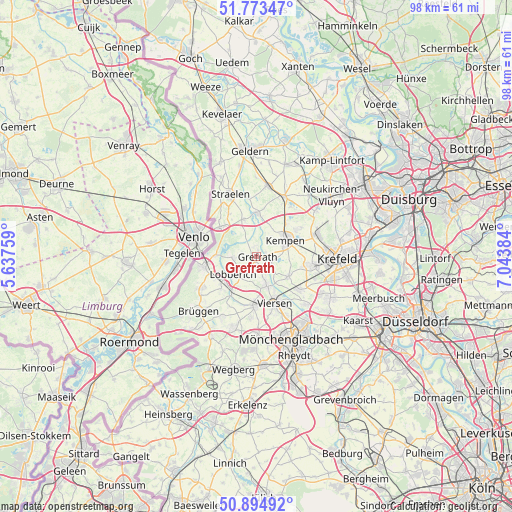
Grefrath GPS coordinates[2]
51° 20' 10.68" North, 6° 20' 26.592" East
| Map corner | latitude | longitude |
|---|---|---|
| Upper-left | 51.77347°, | 5.63759° |
| Center: | 51.3363°, | 6.34072° |
| Lower-right: | 50.89492°, | 7.04384° |
| Map W x H: | 97.7×97.7 km | = 60.7×60.7mi |
| max Lat: | 55.01917° ⇑36.2% North |
| Grefrath: | 51.3363° |
| min Lat: | ⇓63.8% South 47.40724° |
| min Long | Grefrath | max Long |
| 5.92978° | 6.34072° | 14.98853° |
| W 1.1%⇐ | ⇒98.9% E |
Elevation
Elevation of Grefrath is 38 m = 125 ft, and this is 211.1 m = 693 ft below average elevation for this country.
| Max E: |
1256 m = 4121 ft | 83.7% |
| Avg. | 249.1 m = 817 ft | |
| Grefrath | 38 m = 125 ft | |
Min E: |
-5 m = -16 ft | 16.3% |
See also: Germany elevation on elevation.city.
Geographical zone
Grefrath is located in North temperate zone (between Tropic of Cancer and the Arctic Circle). Distance of this North polar circle is 1693.1 km =1052 mi to North.| Distance of | km | miles | from Grefrath |
|---|---|---|---|
| North Pole | 4299 | 2671.3 | to North |
| Arctic Circle | 1693.1 | 1052 | to North |
| Tropic Cancer | 3102.1 | 1927.6 | to South |
| Equator | 5708.1 | 3546.8 | to South |


Nearby cities:
15 places around Grefrath: (largest is in red/bold)
• Brüggen
15.2 km =9.4 mi,  225°
225°
• Geldern
20.4 km =12.7 mi,  356°
356°
• Kempen
6.2 km =3.9 mi,  60°
60°
• Korschenbroich
20.1 km =12.5 mi,  143°
143°
• Krefeld
14.8 km =9.2 mi,  89°
89°
• Mönchengladbach
18.2 km =11.3 mi,  157°
157°
• Nettetal
4.5 km =2.8 mi,  241°
241°
• Niederkrüchten
17.4 km =10.8 mi,  209°
209°
• Rheurdt
16.9 km =10.5 mi,  31°
31°
• Schwalmtal
14.3 km =8.9 mi,  201°
201°
• Straelen
12.8 km =8 mi,  336°
336°
• Tönisvorst
10.8 km =6.7 mi,  99°
99°
• Viersen
9.8 km =6.1 mi, 157°
• Wachtendonk
8.1 km =5 mi, 359°
• Willich
16.5 km =10.3 mi,  119°
119°
Sources, notices
• [Note1] Compared only with cities in Germany existing in our database
• [Src1] Map data: © OpenStreetMap contributors (CC-BY-SA)
• [Src2] Other city data from geonames.org with taken over terms of usage.
• [Src3] Geographical zone / Annual Mean Temperature by Robert A. Rohde @ Wikipedia
