Mittegroßefehn geodata
Mittegroßefehn (Lower Saxony) is a populated place; located in Germany in Europe/Berlin (GMT+2) time zone. With population of 13,314 people, there are 1202 cities with bigger population in this country. Compared to other cities in Germany, 84.5% of cities are located further ↓South; 85.8% of cities are located further →East and 98.6% of cities have higher elevation than Mittegroßefehn. Note1


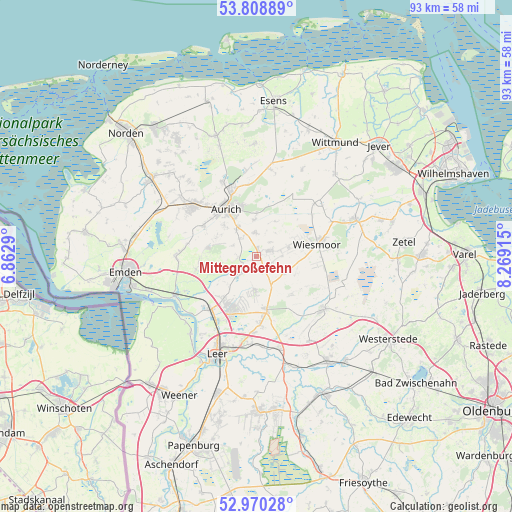
Mittegroßefehn GPS coordinates[2]
53° 23' 29.94" North, 7° 33' 57.672" East
| Map corner | latitude | longitude |
|---|---|---|
| Upper-left | 53.80889°, | 6.8629° |
| Center: | 53.39165°, | 7.56602° |
| Lower-right: | 52.97028°, | 8.26915° |
| Map W x H: | 93.2×93.2 km | = 57.9×57.9mi |
| max Lat: | 55.01917° ⇑15.5% North |
| Mittegroßefehn: | 53.39165° |
| min Lat: | ⇓84.5% South 47.40724° |
| min Long | Mittegroßefehn | max Long |
| 5.92978° | 7.56602° | 14.98853° |
| W 14.2%⇐ | ⇒85.8% E |
Elevation
Elevation of Mittegroßefehn is 1 m = 3 ft, and this is 248.1 m = 814 ft below average elevation for this country.
| Max E: |
1256 m = 4121 ft | 98.6% |
| Avg. | 249.1 m = 817 ft | |
| Mittegroßefehn | 1 m = 3 ft | |
Min E: |
-5 m = -16 ft | 1.4% |
See also: Germany elevation on elevation.city.
Geographical zone
Mittegroßefehn is located in North temperate zone (between Tropic of Cancer and the Arctic Circle). Distance of this North polar circle is 1464.6 km =910.1 mi to North.| Distance of | km | miles | from Mittegroßefehn |
|---|---|---|---|
| North Pole | 4070.5 | 2529.3 | to North |
| Arctic Circle | 1464.6 | 910.1 | to North |
| Tropic Cancer | 3330.7 | 2069.6 | to South |
| Equator | 5936.6 | 3688.8 | to South |


Nearby cities:
15 places around Mittegroßefehn: (largest is in red/bold)
• Aurich
10.3 km =6.4 mi,  327°
327°
• Blomberg
20.6 km =12.8 mi,  358°
358°
• Brinkum
13.9 km =8.6 mi,  179°
179°
• Eversmeer
20.7 km =12.9 mi, 334°
• Filsum
17.1 km =10.6 mi,  166°
166°
• Firrel
9.3 km =5.8 mi,  134°
134°
• Friedeburg
18.9 km =11.7 mi,  69°
69°
• Hesel
10.4 km =6.5 mi, 167°
• Holtland
12.1 km =7.5 mi, 174°
• Jemgum
18.4 km =11.4 mi,  221°
221°
• Leer
19.1 km =11.9 mi,  201°
201°
• Neukamperfehn
6.1 km =3.8 mi, 182°
• Nortmoor
16.2 km =10.1 mi, 178°
• Schwerinsdorf
11 km =6.8 mi,  145°
145°
• Wiesmoor
11.4 km =7.1 mi,  75°
75°
Sources, notices
• [Note1] Compared only with cities in Germany existing in our database
• [Src1] Map data: © OpenStreetMap contributors (CC-BY-SA)
• [Src2] Other city data from geonames.org with taken over terms of usage.
• [Src3] Geographical zone / Annual Mean Temperature by Robert A. Rohde @ Wikipedia
