Meuro geodata
Meuro (Saxony-Anhalt) is a populated place; located in Germany in Europe/Berlin (GMT+2) time zone. With population of 627 people, there are 8671 cities with bigger population in this country. Compared to other cities in Germany, 69.1% of cities are located further ↓South; 89.8% of cities are located further ←West and 64.5% of cities have higher elevation than Meuro. Note1
Administrative division(s):
- Level 1: Saxony-Anhalt
- Level 3: Landkreis Wittenberg
- Level 4: Bad Schmiedeberg


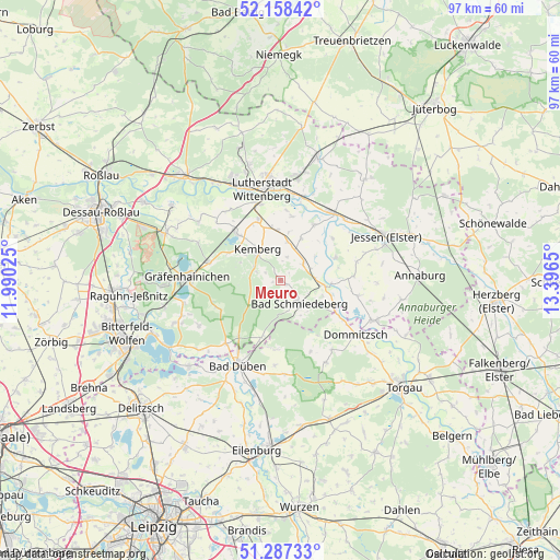
Meuro GPS coordinates[2]
51° 43' 29.892" North, 12° 41' 36.132" East
| Map corner | latitude | longitude |
|---|---|---|
| Upper-left | 52.15842°, | 11.99025° |
| Center: | 51.72497°, | 12.69337° |
| Lower-right: | 51.28733°, | 13.3965° |
| Map W x H: | 96.9×96.9 km | = 60.2×60.2mi |
| max Lat: | 55.01917° ⇑30.9% North |
| Meuro: | 51.72497° |
| min Lat: | ⇓69.1% South 47.40724° |
| min Long | Meuro | max Long |
| 5.92978° | 12.69337° | 14.98853° |
| W 89.8%⇐ | ⇒10.2% E |
Elevation
Elevation of Meuro is 124 m = 407 ft, and this is 125.1 m = 410 ft below average elevation for this country.
| Max E: |
1256 m = 4121 ft | 64.5% |
| Avg. | 249.1 m = 817 ft | |
| Meuro | 124 m = 407 ft | |
Min E: |
-5 m = -16 ft | 35.5% |
See also: Germany elevation on elevation.city.
Geographical zone
Meuro is located in North temperate zone (between Tropic of Cancer and the Arctic Circle). Distance of this North polar circle is 1649.9 km =1025.2 mi to North.| Distance of | km | miles | from Meuro |
|---|---|---|---|
| North Pole | 4255.8 | 2644.4 | to North |
| Arctic Circle | 1649.9 | 1025.2 | to North |
| Tropic Cancer | 3145.4 | 1954.5 | to South |
| Equator | 5751.3 | 3573.7 | to South |


Nearby cities:
15 places around Meuro: (largest is in red/bold)
• Ateritz
4.5 km =2.8 mi,  290°
290°
• Bad Schmiedeberg
5.3 km =3.3 mi,  147°
147°
• Bergwitz
10.6 km =6.6 mi,  317°
317°
• Dabrun
12.1 km =7.5 mi,  5°
5°
• Eutzsch
11.3 km =7 mi,  339°
339°
• Kemberg
6.7 km =4.2 mi, 321°
• Klöden
10.4 km =6.5 mi,  66°
66°
• Kossa
12 km =7.5 mi,  183°
183°
• Pretzsch
7.9 km =4.9 mi,  98°
98°
• Rackith
8.8 km =5.5 mi,  356°
356°
• Radis
12.7 km =7.9 mi,  283°
283°
• Rotta
7.6 km =4.7 mi,  304°
304°
• Schköna
11.8 km =7.3 mi,  245°
245°
• Söllichau
10.5 km =6.5 mi,  197°
197°
• Wartenburg
11.1 km =6.9 mi,  32°
32°
Sources, notices
• [Note1] Compared only with cities in Germany existing in our database
• [Src1] Map data: © OpenStreetMap contributors (CC-BY-SA)
• [Src2] Other city data from geonames.org with taken over terms of usage.
• [Src3] Geographical zone / Annual Mean Temperature by Robert A. Rohde @ Wikipedia
