Söllichau geodata
Söllichau (Saxony-Anhalt) is a populated place; located in Germany in Europe/Berlin (GMT+2) time zone. With population of 886 people, there are 7572 cities with bigger population in this country. Compared to other cities in Germany, 68.1% of cities are located further ↓South; 89.3% of cities are located further ←West and 63.2% of cities have higher elevation than Söllichau. Note1
Administrative division(s):
- Level 1: Saxony-Anhalt
- Level 3: Landkreis Wittenberg
- Level 4: Bad Schmiedeberg


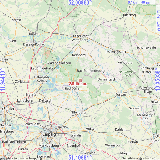
Söllichau GPS coordinates[2]
51° 38' 7.152" North, 12° 38' 50.1" East
| Map corner | latitude | longitude |
|---|---|---|
| Upper-left | 52.06963°, | 11.94413° |
| Center: | 51.63532°, | 12.64725° |
| Lower-right: | 51.19681°, | 13.35038° |
| Map W x H: | 97×97 km | = 60.3×60.3mi |
| max Lat: | 55.01917° ⇑31.9% North |
| Söllichau: | 51.63532° |
| min Lat: | ⇓68.1% South 47.40724° |
| min Long | Söllichau | max Long |
| 5.92978° | 12.64725° | 14.98853° |
| W 89.3%⇐ | ⇒10.7% E |
Elevation
Elevation of Söllichau is 131 m = 430 ft, and this is 118.1 m = 387 ft below average elevation for this country.
| Max E: |
1256 m = 4121 ft | 63.2% |
| Avg. | 249.1 m = 817 ft | |
| Söllichau | 131 m = 430 ft | |
Min E: |
-5 m = -16 ft | 36.8% |
See also: Germany elevation on elevation.city.
Geographical zone
Söllichau is located in North temperate zone (between Tropic of Cancer and the Arctic Circle). Distance of this North polar circle is 1659.9 km =1031.4 mi to North.| Distance of | km | miles | from Söllichau |
|---|---|---|---|
| North Pole | 4265.8 | 2650.6 | to North |
| Arctic Circle | 1659.9 | 1031.4 | to North |
| Tropic Cancer | 3135.4 | 1948.2 | to South |
| Equator | 5741.3 | 3567.5 | to South |


Nearby cities:
15 places around Söllichau: (largest is in red/bold)
• Ateritz
11.6 km =7.2 mi,  354°
354°
• Bad Düben
6.5 km =4 mi,  221°
221°
• Bad Schmiedeberg
8.2 km =5.1 mi,  47°
47°
• Gossa
14.5 km =9 mi,  285°
285°
• Kossa
3.1 km =1.9 mi,  130°
130°
• Krina
11.3 km =7 mi,  281°
281°
• Laußig
9.9 km =6.2 mi,  187°
187°
• Löbnitz
13.6 km =8.5 mi,  249°
249°
• Meuro
10.5 km =6.5 mi,  17°
17°
• Pretzsch
14.1 km =8.8 mi, 51°
• Rotta
14.7 km =9.1 mi, 347°
• Rösa
11 km =6.8 mi,  258°
258°
• Schköna
9.1 km =5.7 mi,  303°
303°
• Schwemsal
6.3 km =3.9 mi, 261°
• Trossin
11.9 km =7.4 mi,  100°
100°
Sources, notices
• [Note1] Compared only with cities in Germany existing in our database
• [Src1] Map data: © OpenStreetMap contributors (CC-BY-SA)
• [Src2] Other city data from geonames.org with taken over terms of usage.
• [Src3] Geographical zone / Annual Mean Temperature by Robert A. Rohde @ Wikipedia
