Am Mellensee geodata
Am Mellensee (Brandenburg) is a seat of a fourth-order administrative division; located in Germany in Europe/Berlin (GMT+2) time zone. In our database, there are 11009 cities with bigger population. Compared to other cities in Germany, 73.9% of cities are located further ↓South; 95.1% of cities are located further ←West and 83.7% of cities have higher elevation than Am Mellensee. Note1
Administrative division(s):
- Level 1: Brandenburg
- Level 3: Landkreis Teltow-Fläming
- Level 4: Am Mellensee


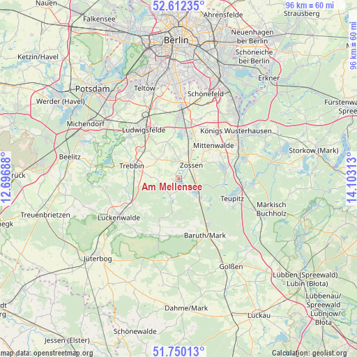
Am Mellensee GPS coordinates[2]
52° 10' 59.988" North, 13° 24' 0" East
| Map corner | latitude | longitude |
|---|---|---|
| Upper-left | 52.61235°, | 12.69688° |
| Center: | 52.18333°, | 13.4° |
| Lower-right: | 51.75013°, | 14.10313° |
| Map W x H: | 95.9×95.9 km | = 59.6×59.6mi |
| max Lat: | 55.01917° ⇑26.1% North |
| Am Mellensee: | 52.18333° |
| min Lat: | ⇓73.9% South 47.40724° |
| min Long | Am Mellensee | max Long |
| 5.92978° | 13.4° | 14.98853° |
| W 95.1%⇐ | ⇒4.9% E |
Elevation
Elevation of Am Mellensee is 38 m = 125 ft, and this is 211.1 m = 693 ft below average elevation for this country.
| Max E: |
1256 m = 4121 ft | 83.7% |
| Avg. | 249.1 m = 817 ft | |
| Am Mellensee | 38 m = 125 ft | |
Min E: |
-5 m = -16 ft | 16.3% |
See also: Germany elevation on elevation.city.
Geographical zone
Am Mellensee is located in North temperate zone (between Tropic of Cancer and the Arctic Circle). Distance of this North polar circle is 1598.9 km =993.5 mi to North.| Distance of | km | miles | from Am Mellensee |
|---|---|---|---|
| North Pole | 4204.8 | 2612.7 | to North |
| Arctic Circle | 1598.9 | 993.5 | to North |
| Tropic Cancer | 3196.3 | 1986.1 | to South |
| Equator | 5802.2 | 3605.3 | to South |


Nearby cities:
15 places around Am Mellensee: (largest is in red/bold)
• Baruth
16.9 km =10.5 mi,  155°
155°
• Bestensee
17.3 km =10.7 mi,  68°
68°
• Groß Köris
17.8 km =11.1 mi,  96°
96°
• Großbeeren
20.4 km =12.7 mi,  342°
342°
• Königs Wusterhausen
20.6 km =12.8 mi,  50°
50°
• Luckenwalde
18.9 km =11.7 mi,  236°
236°
• Ludwigsfelde
16.6 km =10.3 mi,  323°
323°
• Mittenwalde
12.8 km =8 mi, 48°
• Rangsdorf
12.1 km =7.5 mi,  6°
6°
• Schwerin
16.3 km =10.1 mi, 103°
• Sperenberg
5.3 km =3.3 mi,  206°
206°
• Teupitz
16.1 km =10 mi,  111°
111°
• Trebbin
12.5 km =7.8 mi,  287°
287°
• Wildau
21.7 km =13.5 mi, 46°
• Zossen
4.9 km =3 mi,  42°
42°
Sources, notices
• [Note1] Compared only with cities in Germany existing in our database
• [Src1] Map data: © OpenStreetMap contributors (CC-BY-SA)
• [Src2] Other city data from geonames.org with taken over terms of usage.
• [Src3] Geographical zone / Annual Mean Temperature by Robert A. Rohde @ Wikipedia
