Großerlach geodata
Großerlach (Baden-Württemberg) is a seat of a fourth-order administrative division; located in Germany in Europe/Berlin (GMT+2) time zone. With population of 2,636 people, there are 4302 cities with bigger population in this country. Compared to other cities in Germany, 82.4% of cities are located further ↑North; 57.6% of cities are located further →East and 90.6% of cities have lower elevation than Großerlach. Note1
Administrative division(s):
- Level 1: Baden-Württemberg
- Level 2: Regierungsbezirk Stuttgart
- Level 3: Rems-Murr-Kreis
- Level 4: Großerlach


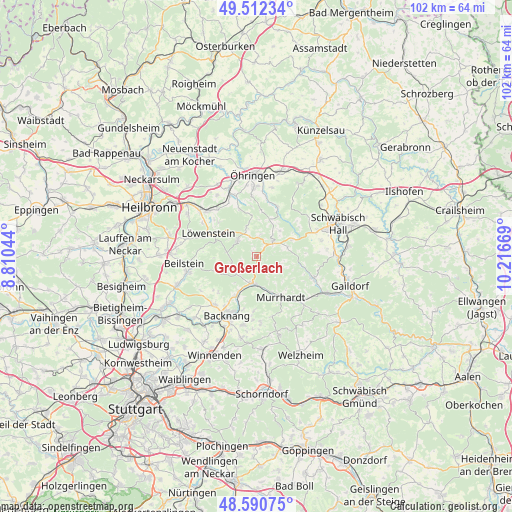
Großerlach GPS coordinates[2]
49° 3' 13.248" North, 9° 30' 48.816" East
| Map corner | latitude | longitude |
|---|---|---|
| Upper-left | 49.51234°, | 8.81044° |
| Center: | 49.05368°, | 9.51356° |
| Lower-right: | 48.59075°, | 10.21669° |
| Map W x H: | 102.5×102.5 km | = 63.7×63.7mi |
| max Lat: | 55.01917° ⇑82.4% North |
| Großerlach: | 49.05368° |
| min Lat: | ⇓17.6% South 47.40724° |
| min Long | Großerlach | max Long |
| 5.92978° | 9.51356° | 14.98853° |
| W 42.4%⇐ | ⇒57.6% E |
Elevation
Elevation of Großerlach is 522 m = 1713 ft, and this is 272.9 m = 895 ft above average elevation for this country.
| Max E: |
1256 m = 4121 ft | 9.4% |
| Großerlach | 522 m 1713 ft | |
| Avg. | 249.1 m = 817 ft | |
Min E: |
-5 m = -16 ft | 90.6% |
See also: Germany elevation on elevation.city.
Geographical zone
Großerlach is located in North temperate zone (between Tropic of Cancer and the Arctic Circle). Distance of this North polar circle is 1946.9 km =1209.7 mi to North.| Distance of | km | miles | from Großerlach |
|---|---|---|---|
| North Pole | 4552.8 | 2829 | to North |
| Arctic Circle | 1946.9 | 1209.7 | to North |
| Tropic Cancer | 2848.3 | 1769.9 | to South |
| Equator | 5454.3 | 3389.1 | to South |


Nearby cities:
15 places around Großerlach: (largest is in red/bold)
• Aspach
12.7 km =7.9 mi,  220°
220°
• Backnang
13.1 km =8.1 mi,  205°
205°
• Beilstein
14.6 km =9.1 mi,  264°
264°
• Löwenstein
10.8 km =6.7 mi,  295°
295°
• Mainhardt
4 km =2.5 mi,  51°
51°
• Michelfeld
13 km =8.1 mi,  67°
67°
• Mittelschöntal
14.7 km =9.1 mi, 215°
• Murrhardt
9 km =5.6 mi,  152°
152°
• Oberrot
12 km =7.5 mi,  111°
111°
• Oberstenfeld
14.4 km =8.9 mi, 257°
• Oppenweiler
8.9 km =5.5 mi, 206°
• Pfedelbach
13.8 km =8.6 mi,  357°
357°
• Spiegelberg
5.2 km =3.2 mi,  254°
254°
• Sulzbach an der Murr
5.7 km =3.5 mi,  189°
189°
• Wüstenrot
4.9 km =3 mi,  308°
308°
Sources, notices
• [Note1] Compared only with cities in Germany existing in our database
• [Src1] Map data: © OpenStreetMap contributors (CC-BY-SA)
• [Src2] Other city data from geonames.org with taken over terms of usage.
• [Src3] Geographical zone / Annual Mean Temperature by Robert A. Rohde @ Wikipedia
