Lienen geodata
Lienen (North Rhine-Westphalia) is a seat of a fourth-order administrative division; located in Germany in Europe/Berlin (GMT+2) time zone. With population of 8,797 people, there are 1823 cities with bigger population in this country. Compared to other cities in Germany, 73.5% of cities are located further ↓South; 77.5% of cities are located further →East and 70% of cities have higher elevation than Lienen. Note1
Administrative division(s):
- Level 1: North Rhine-Westphalia
- Level 2: Regierungsbezirk Münster
- Level 3: Kreis Steinfurt
- Level 4: Lienen


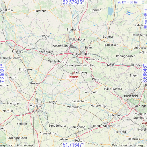
Lienen GPS coordinates[2]
52° 9' 0" North, 7° 58' 59.988" East
| Map corner | latitude | longitude |
|---|---|---|
| Upper-left | 52.57935°, | 7.28021° |
| Center: | 52.15°, | 7.98333° |
| Lower-right: | 51.71647°, | 8.68646° |
| Map W x H: | 95.9×95.9 km | = 59.6×59.6mi |
| max Lat: | 55.01917° ⇑26.5% North |
| Lienen: | 52.15° |
| min Lat: | ⇓73.5% South 47.40724° |
| min Long | Lienen | max Long |
| 5.92978° | 7.98333° | 14.98853° |
| W 22.5%⇐ | ⇒77.5% E |
Elevation
Elevation of Lienen is 91 m = 299 ft, and this is 158.1 m = 519 ft below average elevation for this country.
| Max E: |
1256 m = 4121 ft | 70% |
| Avg. | 249.1 m = 817 ft | |
| Lienen | 91 m = 299 ft | |
Min E: |
-5 m = -16 ft | 30% |
See also: Germany elevation on elevation.city.
Geographical zone
Lienen is located in North temperate zone (between Tropic of Cancer and the Arctic Circle). Distance of this North polar circle is 1602.6 km =995.8 mi to North.| Distance of | km | miles | from Lienen |
|---|---|---|---|
| North Pole | 4208.5 | 2615 | to North |
| Arctic Circle | 1602.6 | 995.8 | to North |
| Tropic Cancer | 3192.6 | 1983.8 | to South |
| Equator | 5798.5 | 3603 | to South |


Nearby cities:
15 places around Lienen: (largest is in red/bold)
• Bad Iburg
4.1 km =2.5 mi,  82°
82°
• Bad Laer
8.8 km =5.5 mi,  129°
129°
• Bad Rothenfelde
13.1 km =8.1 mi,  106°
106°
• Bissendorf
15.6 km =9.7 mi,  53°
53°
• Dissen
15.2 km =9.4 mi,  104°
104°
• Georgsmarienhütte
7.2 km =4.5 mi,  35°
35°
• Glandorf
7.3 km =4.5 mi,  171°
171°
• Hagen
5.2 km =3.2 mi,  357°
357°
• Hasbergen
9.9 km =6.2 mi,  351°
351°
• Hilter
11.3 km =7 mi, 98°
• Lengerich
9.3 km =5.8 mi,  295°
295°
• Lotte
15.5 km =9.6 mi,  342°
342°
• Osnabrück
14.4 km =8.9 mi,  18°
18°
• Ostbevern
15.6 km =9.7 mi,  218°
218°
• Tecklenburg
13.9 km =8.6 mi, 303°
Sources, notices
• [Note1] Compared only with cities in Germany existing in our database
• [Src1] Map data: © OpenStreetMap contributors (CC-BY-SA)
• [Src2] Other city data from geonames.org with taken over terms of usage.
• [Src3] Geographical zone / Annual Mean Temperature by Robert A. Rohde @ Wikipedia
