Lehre geodata
Lehre (Lower Saxony) is a seat of a fourth-order administrative division; located in Germany in Europe/Berlin (GMT+2) time zone. With population of 11,777 people, there are 1393 cities with bigger population in this country. Compared to other cities in Germany, 75.5% of cities are located further ↓South; 61.9% of cities are located further ←West and 72.3% of cities have higher elevation than Lehre. Note1


Lehre GPS coordinates[2]
52° 19' 59.988" North, 10° 40' 0.012" East
| Map corner | latitude | longitude |
|---|---|---|
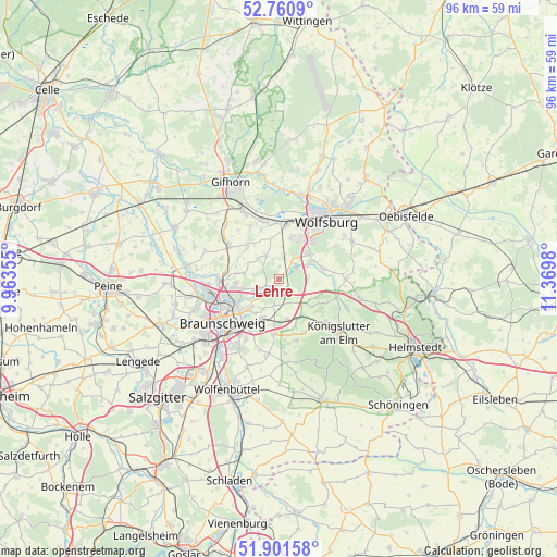
| Upper-left | 52.7609°, | 9.96355° |
| Center: | 52.33333°, | 10.66667° |
| Lower-right: | 51.90158°, | 11.3698° |
| Map W x H: | 95.5×95.5 km | = 59.3×59.3mi |
| max Lat: | 55.01917° ⇑24.5% North |
| Lehre: | 52.33333° |
| min Lat: | ⇓75.5% South 47.40724° |
| min Long | Lehre | max Long |
| 5.92978° | 10.66667° | 14.98853° |
| W 61.9%⇐ | ⇒38.1% E |
Elevation
Elevation of Lehre is 76 m = 249 ft, and this is 173.1 m = 568 ft below average elevation for this country.
| Max E: |
1256 m = 4121 ft | 72.3% |
| Avg. | 249.1 m = 817 ft | |
| Lehre | 76 m = 249 ft | |
Min E: |
-5 m = -16 ft | 27.7% |
See also: Germany elevation on elevation.city.
Geographical zone
Lehre is located in North temperate zone (between Tropic of Cancer and the Arctic Circle). Distance of this North polar circle is 1582.3 km =983.2 mi to North.| Distance of | km | miles | from Lehre |
|---|---|---|---|
| North Pole | 4188.1 | 2602.4 | to North |
| Arctic Circle | 1582.3 | 983.2 | to North |
| Tropic Cancer | 3213 | 1996.5 | to South |
| Equator | 5818.9 | 3615.7 | to South |


Nearby cities:
15 places around Lehre: (largest is in red/bold)
• Abbesbüttel
7.8 km =4.8 mi,  285°
285°
• Allerbüttel
9.9 km =6.2 mi,  349°
349°
• Bechtsbüttel
8.6 km =5.3 mi,  273°
273°
• Bevenrode
6.1 km =3.8 mi,  277°
277°
• Braunschweig
12.1 km =7.5 mi,  231°
231°
• Calberlah
10.2 km =6.3 mi,  343°
343°
• Cremlingen
9.3 km =5.8 mi,  186°
186°
• Destedt
11 km =6.8 mi,  164°
164°
• Detmerode
8.3 km =5.2 mi,  40°
40°
• Isenbüttel
12.5 km =7.8 mi,  333°
333°
• Meine
10.4 km =6.5 mi,  303°
303°
• Vordorf
10.6 km =6.6 mi, 289°
• Wasbüttel
10.2 km =6.3 mi, 330°
• Westhagen
9.3 km =5.8 mi,  32°
32°
• Wolfsburg
12.8 km =8 mi, 37°
Sources, notices
• [Note1] Compared only with cities in Germany existing in our database
• [Src1] Map data: © OpenStreetMap contributors (CC-BY-SA)
• [Src2] Other city data from geonames.org with taken over terms of usage.
• [Src3] Geographical zone / Annual Mean Temperature by Robert A. Rohde @ Wikipedia
