Sankt Georgen im Schwarzwald geodata
Sankt Georgen im Schwarzwald (Baden-Württemberg) is a populated place; located in Germany in Europe/Berlin (GMT+2) time zone. With population of 13,636 people, there are 1174 cities with bigger population in this country. Compared to other cities in Germany, 93.7% of cities are located further ↑North; 72.6% of cities are located further →East and 99.5% of cities have lower elevation than Sankt Georgen im Schwarzwald. Note1
Administrative division(s):
- Level 1: Baden-Württemberg
- Level 2: Freiburg Region
- Level 3: Schwarzwald-Baar-Kreis
- Level 4: St. Georgen im Schwarzwald
Current local time in Sankt Georgen im Schwarzwald:
10:42 AM, FridayDifference from your time zone: hours


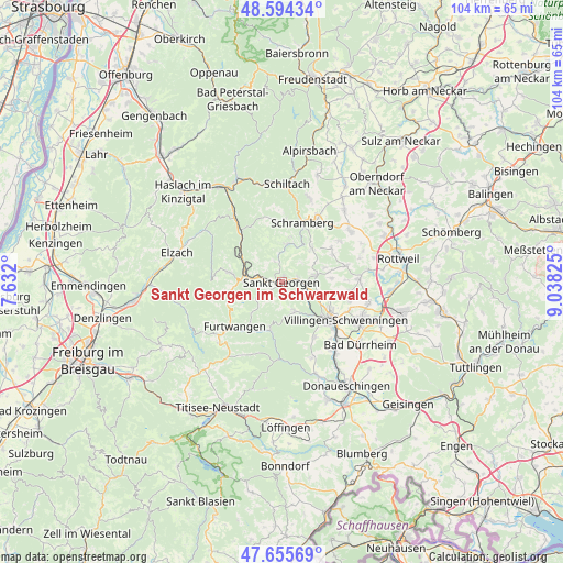
Sankt Georgen im Schwarzwald GPS coordinates[2]
48° 7' 37.776" North, 8° 20' 6.468" East
| Map corner | latitude | longitude |
|---|---|---|
| Upper-left | 48.59434°, | 7.632° |
| Center: | 48.12716°, | 8.33513° |
| Lower-right: | 47.65569°, | 9.03825° |
| Map W x H: | 104.4×104.4 km | = 64.9×64.9mi |
| max Lat: | 55.01917° ⇑93.7% North |
| Sankt Georgen im Schwarzwald: | 48.12716° |
| min Lat: | ⇓6.3% South 47.40724° |
| min Long | Sankt Georgen i | max Long |
| 5.92978° | 8.33513° | 14.98853° |
| W 27.4%⇐ | ⇒72.6% E |
Elevation
Elevation of Sankt Georgen im Schwarzwald is 852 m = 2795 ft, and this is 602.9 m = 1978 ft above average elevation for this country.
| Max E: |
1256 m = 4121 ft | 0.5% |
| Sankt Georgen im Schwarzwald | 852 m 2795 ft | |
| Avg. | 249.1 m = 817 ft | |
Min E: |
-5 m = -16 ft | 99.5% |
See also: Germany elevation on elevation.city.
Geographical zone
Sankt Georgen im Schwarzwald is located in North temperate zone (between Tropic of Cancer and the Arctic Circle). Distance of this North polar circle is 2049.9 km =1273.7 mi to North.| Distance of | km | miles | from Sankt Georgen im Schwarzwald |
|---|---|---|---|
| North Pole | 4655.8 | 2893 | to North |
| Arctic Circle | 2049.9 | 1273.7 | to North |
| Tropic Cancer | 2745.3 | 1705.8 | to South |
| Equator | 5351.2 | 3325.1 | to South |


Nearby cities:
15 places around Sankt Georgen im Schwarzwald: (largest is in red/bold)
• Furtwangen
12.7 km =7.9 mi,  228°
228°
• Hardt
8.7 km =5.4 mi,  44°
44°
• Hornberg
12 km =7.5 mi,  320°
320°
• Königsfeld im Schwarzwald
6.4 km =4 mi,  78°
78°
• Lauterbach/Schwarzwald
11.4 km =7.1 mi,  2°
2°
• Mönchweiler
7.1 km =4.4 mi,  114°
114°
• Niedereschach
14.7 km =9.1 mi,  87°
87°
• Schonach im Schwarzwald
10 km =6.2 mi,  279°
279°
• Schramberg
11.4 km =7.1 mi,  19°
19°
• Schönwald
10 km =6.2 mi,  256°
256°
• Tennenbronn
7.1 km =4.4 mi,  9°
9°
• Triberg
7.6 km =4.7 mi,  273°
273°
• Unterkirnach
5.8 km =3.6 mi,  156°
156°
• Villingen-Schwenningen
13.8 km =8.6 mi,  121°
121°
• Vöhrenbach
9 km =5.6 mi,  196°
196°
Sources, notices
• [Note1] Compared only with cities in Germany existing in our database
• [Src1] Map data: © OpenStreetMap contributors (CC-BY-SA)
• [Src2] Other city data from geonames.org with taken over terms of usage.
• [Src3] Geographical zone / Annual Mean Temperature by Robert A. Rohde @ Wikipedia
