Königshütte geodata
Königshütte (Saxony-Anhalt) is a populated place; located in Germany in Europe/Berlin (GMT+2) time zone. With population of 563 people, there are 9012 cities with bigger population in this country. Compared to other cities in Germany, 69.3% of cities are located further ↓South; 63.5% of cities are located further ←West and 79.5% of cities have lower elevation than Königshütte. Note1
Administrative division(s):
- Level 1: Saxony-Anhalt
- Level 3: Landkreis Harz
- Level 4: Oberharz am Brocken


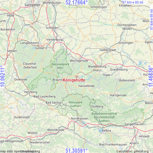
Königshütte GPS coordinates[2]
51° 44' 36.132" North, 10° 45' 54.828" East
| Map corner | latitude | longitude |
|---|---|---|
| Upper-left | 52.17664°, | 10.06211° |
| Center: | 51.74337°, | 10.76523° |
| Lower-right: | 51.30591°, | 11.46836° |
| Map W x H: | 96.8×96.8 km | = 60.1×60.1mi |
| max Lat: | 55.01917° ⇑30.7% North |
| Königshütte: | 51.74337° |
| min Lat: | ⇓69.3% South 47.40724° |
| min Long | Königshütte | max Long |
| 5.92978° | 10.76523° | 14.98853° |
| W 63.5%⇐ | ⇒36.5% E |
Elevation
Elevation of Königshütte is 430 m = 1411 ft, and this is 180.9 m = 594 ft above average elevation for this country.
| Max E: |
1256 m = 4121 ft | 20.5% |
| Königshütte | 430 m 1411 ft | |
| Avg. | 249.1 m = 817 ft | |
Min E: |
-5 m = -16 ft | 79.5% |
See also: Germany elevation on elevation.city.
Geographical zone
Königshütte is located in North temperate zone (between Tropic of Cancer and the Arctic Circle). Distance of this North polar circle is 1647.9 km =1024 mi to North.| Distance of | km | miles | from Königshütte |
|---|---|---|---|
| North Pole | 4253.7 | 2643.1 | to North |
| Arctic Circle | 1647.9 | 1024 | to North |
| Tropic Cancer | 3147.4 | 1955.7 | to South |
| Equator | 5753.3 | 3574.9 | to South |


Nearby cities:
15 places around Königshütte: (largest is in red/bold)
• Benneckenstein
9 km =5.6 mi,  201°
201°
• Blankenburg
14.1 km =8.8 mi,  68°
68°
• Braunlage
10.8 km =6.7 mi,  259°
259°
• Darlingerode
11.8 km =7.3 mi,  348°
348°
• Drübeck
13.2 km =8.2 mi, 345°
• Elbingerode
4.1 km =2.5 mi,  42°
42°
• Elend
5.3 km =3.3 mi,  271°
271°
• Hasselfelde
8.5 km =5.3 mi,  133°
133°
• Heimburg
13.4 km =8.3 mi,  48°
48°
• Hüttenrode
10 km =6.2 mi, 73°
• Reddeber
13.9 km =8.6 mi,  11°
11°
• Rübeland
5.8 km =3.6 mi,  76°
76°
• Schierke
7.5 km =4.7 mi,  287°
287°
• Tanne
5.8 km =3.6 mi,  210°
210°
• Wernigerode
10.4 km =6.5 mi, 6°
Sources, notices
• [Note1] Compared only with cities in Germany existing in our database
• [Src1] Map data: © OpenStreetMap contributors (CC-BY-SA)
• [Src2] Other city data from geonames.org with taken over terms of usage.
• [Src3] Geographical zone / Annual Mean Temperature by Robert A. Rohde @ Wikipedia
