Braunlage geodata
Braunlage (Lower Saxony) is a populated place; located in Germany in Europe/Berlin (GMT+2) time zone. With population of 5,159 people, there are 2764 cities with bigger population in this country. Compared to other cities in Germany, 69.1% of cities are located further ↓South; 61% of cities are located further ←West and 93.3% of cities have lower elevation than Braunlage. Note1


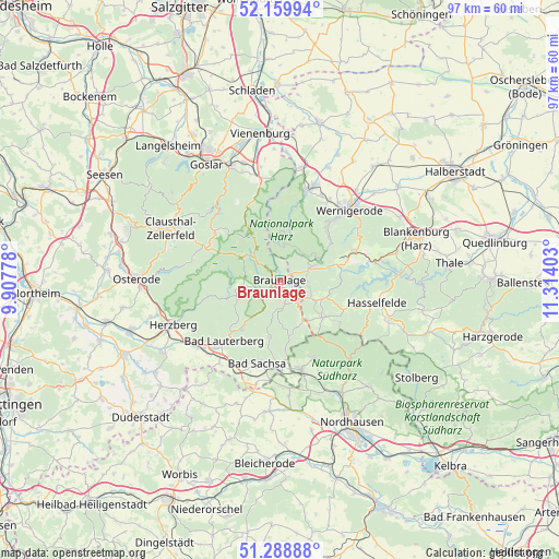
Braunlage GPS coordinates[2]
51° 43' 35.436" North, 10° 36' 39.24" East
| Map corner | latitude | longitude |
|---|---|---|
| Upper-left | 52.15994°, | 9.90778° |
| Center: | 51.72651°, | 10.6109° |
| Lower-right: | 51.28888°, | 11.31403° |
| Map W x H: | 96.9×96.9 km | = 60.2×60.2mi |
| max Lat: | 55.01917° ⇑30.9% North |
| Braunlage: | 51.72651° |
| min Lat: | ⇓69.1% South 47.40724° |
| min Long | Braunlage | max Long |
| 5.92978° | 10.6109° | 14.98853° |
| W 61%⇐ | ⇒39% E |
Elevation
Elevation of Braunlage is 563 m = 1847 ft, and this is 313.9 m = 1030 ft above average elevation for this country.
| Max E: |
1256 m = 4121 ft | 6.7% |
| Braunlage | 563 m 1847 ft | |
| Avg. | 249.1 m = 817 ft | |
Min E: |
-5 m = -16 ft | 93.3% |
See also: Germany elevation on elevation.city.
Geographical zone
Braunlage is located in North temperate zone (between Tropic of Cancer and the Arctic Circle). Distance of this North polar circle is 1649.7 km =1025.1 mi to North.| Distance of | km | miles | from Braunlage |
|---|---|---|---|
| North Pole | 4255.6 | 2644.3 | to North |
| Arctic Circle | 1649.7 | 1025.1 | to North |
| Tropic Cancer | 3145.5 | 1954.5 | to South |
| Equator | 5751.4 | 3573.8 | to South |


Nearby cities:
15 places around Braunlage: (largest is in red/bold)
• Altenau
14.3 km =8.9 mi,  305°
305°
• Bad Lauterberg im Harz
14.2 km =8.8 mi,  222°
222°
• Bad Sachsa
15.1 km =9.4 mi,  194°
194°
• Benneckenstein
9.8 km =6.1 mi,  131°
131°
• Darlingerode
15.7 km =9.8 mi,  31°
31°
• Elbingerode
14.3 km =8.9 mi,  69°
69°
• Elend
5.7 km =3.5 mi, 68°
• Ellrich
16 km =9.9 mi,  166°
166°
• Königshütte
10.8 km =6.7 mi,  79°
79°
• Sankt Andreasberg
6.6 km =4.1 mi,  253°
253°
• Schierke
5.5 km =3.4 mi,  40°
40°
• Tanne
8.3 km =5.2 mi,  112°
112°
• Walkenried
15.9 km =9.9 mi,  178°
178°
• Wieda
10.4 km =6.5 mi, 189°
• Zorge
10.5 km =6.5 mi, 171°
Sources, notices
• [Note1] Compared only with cities in Germany existing in our database
• [Src1] Map data: © OpenStreetMap contributors (CC-BY-SA)
• [Src2] Other city data from geonames.org with taken over terms of usage.
• [Src3] Geographical zone / Annual Mean Temperature by Robert A. Rohde @ Wikipedia
