Kalenborn geodata
Kalenborn (Rheinland-Pfalz) is a seat of a fourth-order administrative division; located in Germany in Europe/Berlin (GMT+2) time zone. In our database, there are 11009 cities with bigger population. Compared to other cities in Germany, 51.7% of cities are located further ↑North; 93.4% of cities are located further →East and 70.4% of cities have lower elevation than Kalenborn. Note1
Administrative division(s):
- Level 1: Rheinland-Pfalz
- Level 3: Landkreis Ahrweiler
- Level 4: Kalenborn


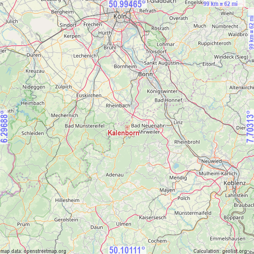
Kalenborn GPS coordinates[2]
50° 33' 0" North, 7° 0' 0" East
| Map corner | latitude | longitude |
|---|---|---|
| Upper-left | 50.99465°, | 6.29688° |
| Center: | 50.55°, | 7° |
| Lower-right: | 50.10111°, | 7.70313° |
| Map W x H: | 99.4×99.4 km | = 61.8×61.8mi |
| max Lat: | 55.01917° ⇑51.7% North |
| Kalenborn: | 50.55° |
| min Lat: | ⇓48.3% South 47.40724° |
| min Long | Kalenborn | max Long |
| 5.92978° | 7° | 14.98853° |
| W 6.6%⇐ | ⇒93.4% E |
Elevation
Elevation of Kalenborn is 361 m = 1184 ft, and this is 111.9 m = 367 ft above average elevation for this country.
| Max E: |
1256 m = 4121 ft | 29.6% |
| Kalenborn | 361 m 1184 ft | |
| Avg. | 249.1 m = 817 ft | |
Min E: |
-5 m = -16 ft | 70.4% |
See also: Germany elevation on elevation.city.
Geographical zone
Kalenborn is located in North temperate zone (between Tropic of Cancer and the Arctic Circle). Distance of this North polar circle is 1780.5 km =1106.4 mi to North.| Distance of | km | miles | from Kalenborn |
|---|---|---|---|
| North Pole | 4386.4 | 2725.6 | to North |
| Arctic Circle | 1780.5 | 1106.4 | to North |
| Tropic Cancer | 3014.7 | 1873.2 | to South |
| Equator | 5620.6 | 3492.5 | to South |


Nearby cities:
15 places around Kalenborn: (largest is in red/bold)
• Ahrbrück
7.6 km =4.7 mi,  186°
186°
• Altenahr
3.7 km =2.3 mi, 188°
• Bad Neuenahr-Ahrweiler
7.9 km =4.9 mi,  95°
95°
• Berg
3.7 km =2.3 mi,  279°
279°
• Dernau
4 km =2.5 mi,  117°
117°
• Heckenbach
9.9 km =6.2 mi,  159°
159°
• Hönningen
9.9 km =6.2 mi,  200°
200°
• Kesseling
7.5 km =4.7 mi,  170°
170°
• Kirchsahr
7.7 km =4.8 mi,  246°
246°
• Lind
7.3 km =4.5 mi,  220°
220°
• Mayschoß
3.5 km =2.2 mi, 159°
• Meckenheim
8.5 km =5.3 mi,  14°
14°
• Rech
4.4 km =2.7 mi,  147°
147°
• Rheinbach
9.1 km =5.7 mi,  336°
336°
• Wachtberg
11.6 km =7.2 mi,  37°
37°
Sources, notices
• [Note1] Compared only with cities in Germany existing in our database
• [Src1] Map data: © OpenStreetMap contributors (CC-BY-SA)
• [Src2] Other city data from geonames.org with taken over terms of usage.
• [Src3] Geographical zone / Annual Mean Temperature by Robert A. Rohde @ Wikipedia
