Ismaning geodata
Ismaning (Bavaria) is a seat of a fourth-order administrative division; located in Germany in Europe/Berlin (GMT+2) time zone. With population of 14,596 people, there are 1087 cities with bigger population in this country. Compared to other cities in Germany, 92.2% of cities are located further ↑North; 76.9% of cities are located further ←West and 87.3% of cities have lower elevation than Ismaning. Note1
Administrative division(s):
- Level 1: Bavaria
- Level 2: Upper Bavaria
- Level 3: Landkreis München
- Level 4: Ismaning


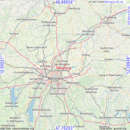
Ismaning GPS coordinates[2]
48° 13' 59.988" North, 11° 40' 59.988" East
| Map corner | latitude | longitude |
|---|---|---|
| Upper-left | 48.69954°, | 10.98021° |
| Center: | 48.23333°, | 11.68333° |
| Lower-right: | 47.76283°, | 12.38646° |
| Map W x H: | 104.2×104.1 km | = 64.7×64.7mi |
| max Lat: | 55.01917° ⇑92.2% North |
| Ismaning: | 48.23333° |
| min Lat: | ⇓7.8% South 47.40724° |
| min Long | Ismaning | max Long |
| 5.92978° | 11.68333° | 14.98853° |
| W 76.9%⇐ | ⇒23.1% E |
Elevation
Elevation of Ismaning is 488 m = 1601 ft, and this is 238.9 m = 784 ft above average elevation for this country.
| Max E: |
1256 m = 4121 ft | 12.7% |
| Ismaning | 488 m 1601 ft | |
| Avg. | 249.1 m = 817 ft | |
Min E: |
-5 m = -16 ft | 87.3% |
See also: Germany elevation on elevation.city.
Geographical zone
Ismaning is located in North temperate zone (between Tropic of Cancer and the Arctic Circle). Distance of this North polar circle is 2038.1 km =1266.4 mi to North.| Distance of | km | miles | from Ismaning |
|---|---|---|---|
| North Pole | 4644 | 2885.6 | to North |
| Arctic Circle | 2038.1 | 1266.4 | to North |
| Tropic Cancer | 2757.1 | 1713.2 | to South |
| Equator | 5363 | 3332.4 | to South |


Nearby cities:
15 places around Ismaning: (largest is in red/bold)
• Aschheim
7.3 km =4.5 mi,  160°
160°
• Bogenhausen
10.3 km =6.4 mi,  209°
209°
• Eching
8.9 km =5.5 mi,  326°
326°
• Eichenried
8.8 km =5.5 mi,  56°
56°
• Feldkirchen
10.1 km =6.3 mi, 159°
• Finsing
10.6 km =6.6 mi,  100°
100°
• Garching bei München
3 km =1.9 mi,  305°
305°
• Hallbergmoos
11.6 km =7.2 mi,  25°
25°
• Kirchheim bei München
8.3 km =5.2 mi,  139°
139°
• Neufahrn bei Freising
9.3 km =5.8 mi,  350°
350°
• Oberschleißheim
8.8 km =5.5 mi,  282°
282°
• Pliening
9.7 km =6 mi,  115°
115°
• Poing
12.2 km =7.6 mi,  125°
125°
• Unterföhring
5.4 km =3.4 mi, 213°
• Unterschleißheim
9.5 km =5.9 mi,  303°
303°
Sources, notices
• [Note1] Compared only with cities in Germany existing in our database
• [Src1] Map data: © OpenStreetMap contributors (CC-BY-SA)
• [Src2] Other city data from geonames.org with taken over terms of usage.
• [Src3] Geographical zone / Annual Mean Temperature by Robert A. Rohde @ Wikipedia
