Iggensbach geodata
Iggensbach (Bavaria) is a seat of a fourth-order administrative division; located in Germany in Europe/Berlin (GMT+2) time zone. With population of 2,132 people, there are 4887 cities with bigger population in this country. Compared to other cities in Germany, 86.1% of cities are located further ↑North; 93.3% of cities are located further ←West and 73% of cities have lower elevation than Iggensbach. Note1
Administrative division(s):
- Level 1: Bavaria
- Level 2: Lower Bavaria
- Level 3: Landkreis Deggendorf
- Level 4: Iggensbach


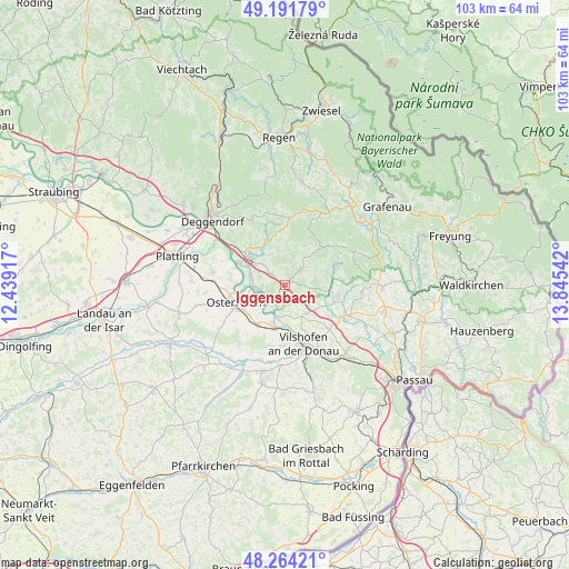
Iggensbach GPS coordinates[2]
48° 43' 48.504" North, 13° 8' 32.244" East
| Map corner | latitude | longitude |
|---|---|---|
| Upper-left | 49.19179°, | 12.43917° |
| Center: | 48.73014°, | 13.14229° |
| Lower-right: | 48.26421°, | 13.84542° |
| Map W x H: | 103.1×103.1 km | = 64.1×64.1mi |
| max Lat: | 55.01917° ⇑86.1% North |
| Iggensbach: | 48.73014° |
| min Lat: | ⇓13.9% South 47.40724° |
| min Long | Iggensbach | max Long |
| 5.92978° | 13.14229° | 14.98853° |
| W 93.3%⇐ | ⇒6.7% E |
Elevation
Elevation of Iggensbach is 382 m = 1253 ft, and this is 132.9 m = 436 ft above average elevation for this country.
| Max E: |
1256 m = 4121 ft | 27% |
| Iggensbach | 382 m 1253 ft | |
| Avg. | 249.1 m = 817 ft | |
Min E: |
-5 m = -16 ft | 73% |
See also: Germany elevation on elevation.city.
Geographical zone
Iggensbach is located in North temperate zone (between Tropic of Cancer and the Arctic Circle). Distance of this North polar circle is 1982.9 km =1232.1 mi to North.| Distance of | km | miles | from Iggensbach |
|---|---|---|---|
| North Pole | 4588.8 | 2851.3 | to North |
| Arctic Circle | 1982.9 | 1232.1 | to North |
| Tropic Cancer | 2812.4 | 1747.5 | to South |
| Equator | 5418.3 | 3366.8 | to South |


Nearby cities:
15 places around Iggensbach: (largest is in red/bold)
• Aicha vorm Wald
12.7 km =7.9 mi,  118°
118°
• Auerbach
8.7 km =5.4 mi,  338°
338°
• Außernzell
4.5 km =2.8 mi,  98°
98°
• Grattersdorf
8.2 km =5.1 mi,  5°
5°
• Hengersberg
8 km =5 mi,  306°
306°
• Hofkirchen
6 km =3.7 mi,  196°
196°
• Hunding
12.7 km =7.9 mi, 11°
• Künzing
8.3 km =5.2 mi,  211°
211°
• Lalling
12.8 km =8 mi,  359°
359°
• Niederalteich
9.5 km =5.9 mi,  294°
294°
• Osterhofen
9.4 km =5.8 mi,  249°
249°
• Schöllnach
3.7 km =2.3 mi,  44°
44°
• Vilshofen
12 km =7.5 mi,  162°
162°
• Winzer
4.8 km =3 mi,  260°
260°
• Zenting
11 km =6.8 mi,  51°
51°
Sources, notices
• [Note1] Compared only with cities in Germany existing in our database
• [Src1] Map data: © OpenStreetMap contributors (CC-BY-SA)
• [Src2] Other city data from geonames.org with taken over terms of usage.
• [Src3] Geographical zone / Annual Mean Temperature by Robert A. Rohde @ Wikipedia
