Horka geodata
Horka (Saxony) is a populated place; located in Germany in Europe/Berlin (GMT+2) time zone. With population of 2,053 people, there are 4992 cities with bigger population in this country. Compared to other cities in Germany, 62.6% of cities are located further ↓South; 98.8% of cities are located further ←West and 58.1% of cities have higher elevation than Horka. Note1


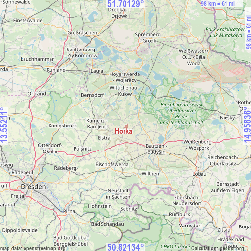
Horka GPS coordinates[2]
51° 15' 48.312" North, 14° 15' 18.828" East
| Map corner | latitude | longitude |
|---|---|---|
| Upper-left | 51.70129°, | 13.55211° |
| Center: | 51.26342°, | 14.25523° |
| Lower-right: | 50.82134°, | 14.95836° |
| Map W x H: | 97.8×97.8 km | = 60.8×60.8mi |
| max Lat: | 55.01917° ⇑37.4% North |
| Horka: | 51.26342° |
| min Lat: | ⇓62.6% South 47.40724° |
| min Long | Horka | max Long |
| 5.92978° | 14.25523° | 14.98853° |
| W 98.8%⇐ | ⇒1.2% E |
Elevation
Elevation of Horka is 167 m = 548 ft, and this is 82.1 m = 269 ft below average elevation for this country.
| Max E: |
1256 m = 4121 ft | 58.1% |
| Avg. | 249.1 m = 817 ft | |
| Horka | 167 m = 548 ft | |
Min E: |
-5 m = -16 ft | 41.9% |
See also: Germany elevation on elevation.city.
Geographical zone
Horka is located in North temperate zone (between Tropic of Cancer and the Arctic Circle). Distance of this North polar circle is 1701.2 km =1057.1 mi to North.| Distance of | km | miles | from Horka |
|---|---|---|---|
| North Pole | 4307.1 | 2676.3 | to North |
| Arctic Circle | 1701.2 | 1057.1 | to North |
| Tropic Cancer | 3094 | 1922.5 | to South |
| Equator | 5700 | 3541.8 | to South |


Nearby cities:
15 places around Horka: (largest is in red/bold)
• Burkau
11.3 km =7 mi,  210°
210°
• Crostwitz
2.9 km =1.8 mi,  196°
196°
• Demitz-Thumitz
13.6 km =8.5 mi,  182°
182°
• Elstra
9.8 km =6.1 mi,  241°
241°
• Göda
10.5 km =6.5 mi,  154°
154°
• Kamenz
11.2 km =7 mi,  272°
272°
• Königswartha
7.3 km =4.5 mi,  44°
44°
• Nebelschütz
6.7 km =4.2 mi, 268°
• Neschwitz
5.2 km =3.2 mi,  81°
81°
• Oßling
12.4 km =7.7 mi,  329°
329°
• Panschwitz-Kuckau
5.2 km =3.2 mi,  230°
230°
• Puschwitz
3.3 km =2.1 mi,  106°
106°
• Radibor
10.2 km =6.3 mi,  101°
101°
• Räckelwitz
2.1 km =1.3 mi, 225°
• Wittichenau
13.5 km =8.4 mi,  356°
356°
Sources, notices
• [Note1] Compared only with cities in Germany existing in our database
• [Src1] Map data: © OpenStreetMap contributors (CC-BY-SA)
• [Src2] Other city data from geonames.org with taken over terms of usage.
• [Src3] Geographical zone / Annual Mean Temperature by Robert A. Rohde @ Wikipedia
