Göda geodata
Göda (Saxony) is a seat of a fourth-order administrative division; located in Germany in Europe/Berlin (GMT+2) time zone. With population of 3,476 people, there are 3629 cities with bigger population in this country. Compared to other cities in Germany, 61.2% of cities are located further ↓South; 98.9% of cities are located further ←West and 52.3% of cities have higher elevation than Göda. Note1


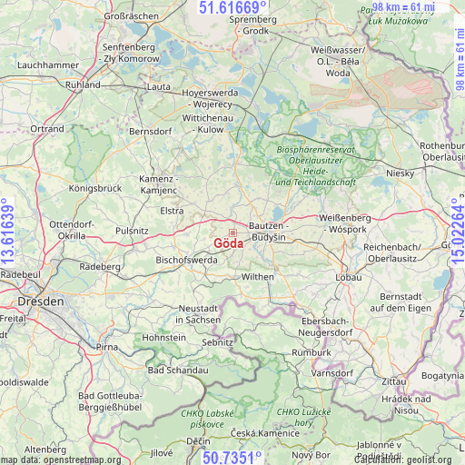
Göda GPS coordinates[2]
51° 10' 40.8" North, 14° 19' 10.236" East
| Map corner | latitude | longitude |
|---|---|---|
| Upper-left | 51.61669°, | 13.61639° |
| Center: | 51.178°, | 14.31951° |
| Lower-right: | 50.7351°, | 15.02264° |
| Map W x H: | 98×98 km | = 60.9×60.9mi |
| max Lat: | 55.01917° ⇑38.8% North |
| Göda: | 51.178° |
| min Lat: | ⇓61.2% South 47.40724° |
| min Long | Göda | max Long |
| 5.92978° | 14.31951° | 14.98853° |
| W 98.9%⇐ | ⇒1.1% E |
Elevation
Elevation of Göda is 209 m = 686 ft, and this is 40.1 m = 132 ft below average elevation for this country.
| Max E: |
1256 m = 4121 ft | 52.3% |
| Avg. | 249.1 m = 817 ft | |
| Göda | 209 m = 686 ft | |
Min E: |
-5 m = -16 ft | 47.7% |
See also: Germany elevation on elevation.city.
Geographical zone
Göda is located in North temperate zone (between Tropic of Cancer and the Arctic Circle). Distance of this North polar circle is 1710.7 km =1063 mi to North.| Distance of | km | miles | from Göda |
|---|---|---|---|
| North Pole | 4316.6 | 2682.2 | to North |
| Arctic Circle | 1710.7 | 1063 | to North |
| Tropic Cancer | 3084.5 | 1916.6 | to South |
| Equator | 5690.5 | 3535.9 | to South |


Nearby cities:
15 places around Göda: (largest is in red/bold)
• Bautzen
8.1 km =5 mi,  88°
88°
• Bischofswerda
11.2 km =7 mi,  240°
240°
• Burkau
10.2 km =6.3 mi,  268°
268°
• Crostwitz
8.6 km =5.3 mi,  321°
321°
• Demitz-Thumitz
6.5 km =4 mi,  231°
231°
• Großpostwitz
10.6 km =6.6 mi,  126°
126°
• Horka
10.5 km =6.5 mi,  334°
334°
• Neschwitz
10.3 km =6.4 mi,  3°
3°
• Neukirch/Lausitz
9 km =5.6 mi,  185°
185°
• Obergurig
7.8 km =4.8 mi, 130°
• Panschwitz-Kuckau
10.5 km =6.5 mi,  306°
306°
• Puschwitz
8.7 km =5.4 mi,  351°
351°
• Radibor
9.2 km =5.7 mi,  36°
36°
• Räckelwitz
10 km =6.2 mi, 323°
• Wilthen
10.3 km =6.4 mi,  150°
150°
Sources, notices
• [Note1] Compared only with cities in Germany existing in our database
• [Src1] Map data: © OpenStreetMap contributors (CC-BY-SA)
• [Src2] Other city data from geonames.org with taken over terms of usage.
• [Src3] Geographical zone / Annual Mean Temperature by Robert A. Rohde @ Wikipedia
