Hohburg geodata
Hohburg (Saxony) is a populated place; located in Germany in Europe/Berlin (GMT+2) time zone. With population of 3,061 people, there are 3946 cities with bigger population in this country. Compared to other cities in Germany, 64.9% of cities are located further ↓South; 90.8% of cities are located further ←West and 63.9% of cities have higher elevation than Hohburg. Note1


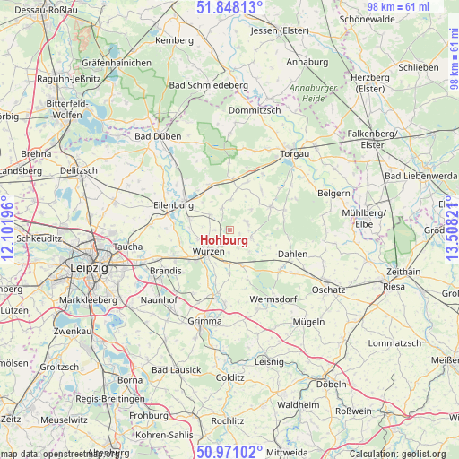
Hohburg GPS coordinates[2]
51° 24' 42.048" North, 12° 48' 18.288" East
| Map corner | latitude | longitude |
|---|---|---|
| Upper-left | 51.84813°, | 12.10196° |
| Center: | 51.41168°, | 12.80508° |
| Lower-right: | 50.97102°, | 13.50821° |
| Map W x H: | 97.5×97.5 km | = 60.6×60.6mi |
| max Lat: | 55.01917° ⇑35.1% North |
| Hohburg: | 51.41168° |
| min Lat: | ⇓64.9% South 47.40724° |
| min Long | Hohburg | max Long |
| 5.92978° | 12.80508° | 14.98853° |
| W 90.8%⇐ | ⇒9.2% E |
Elevation
Elevation of Hohburg is 127 m = 417 ft, and this is 122.1 m = 401 ft below average elevation for this country.
| Max E: |
1256 m = 4121 ft | 63.9% |
| Avg. | 249.1 m = 817 ft | |
| Hohburg | 127 m = 417 ft | |
Min E: |
-5 m = -16 ft | 36.1% |
See also: Germany elevation on elevation.city.
Geographical zone
Hohburg is located in North temperate zone (between Tropic of Cancer and the Arctic Circle). Distance of this North polar circle is 1684.7 km =1046.8 mi to North.| Distance of | km | miles | from Hohburg |
|---|---|---|---|
| North Pole | 4290.6 | 2666.1 | to North |
| Arctic Circle | 1684.7 | 1046.8 | to North |
| Tropic Cancer | 3110.5 | 1932.8 | to South |
| Equator | 5716.4 | 3552 | to South |


Nearby cities:
15 places around Hohburg: (largest is in red/bold)
• Bennewitz
8.5 km =5.3 mi,  228°
228°
• Brandis
15.9 km =9.9 mi,  238°
238°
• Dahlen
14.4 km =8.9 mi,  111°
111°
• Doberschütz
10.5 km =6.5 mi,  337°
337°
• Eilenburg
13.1 km =8.1 mi,  294°
294°
• Falkenhain
4.8 km =3 mi, 107°
• Jesewitz
16.8 km =10.4 mi,  274°
274°
• Machern
12.9 km =8 mi,  247°
247°
• Mockrehna
10.7 km =6.6 mi,  3°
3°
• Nerchau
15.7 km =9.8 mi,  184°
184°
• Schildau
10 km =6.2 mi,  59°
59°
• Thallwitz
8.8 km =5.5 mi, 285°
• Trebsen
14.1 km =8.8 mi,  194°
194°
• Wurzen
6.4 km =4 mi, 225°
• Zschepplin
17.3 km =10.7 mi,  304°
304°
Sources, notices
• [Note1] Compared only with cities in Germany existing in our database
• [Src1] Map data: © OpenStreetMap contributors (CC-BY-SA)
• [Src2] Other city data from geonames.org with taken over terms of usage.
• [Src3] Geographical zone / Annual Mean Temperature by Robert A. Rohde @ Wikipedia
