Eilenburg geodata
Eilenburg (Saxony) is a populated place; located in Germany in Europe/Berlin (GMT+2) time zone. With population of 17,609 people, there are 904 cities with bigger population in this country. Compared to other cities in Germany, 65.7% of cities are located further ↓South; 89.2% of cities are located further ←West and 67.8% of cities have higher elevation than Eilenburg. Note1


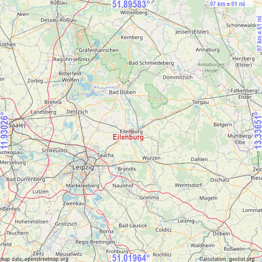
Eilenburg GPS coordinates[2]
51° 27' 35.424" North, 12° 38' 0.168" East
| Map corner | latitude | longitude |
|---|---|---|
| Upper-left | 51.89583°, | 11.93026° |
| Center: | 51.45984°, | 12.63338° |
| Lower-right: | 51.01964°, | 13.33651° |
| Map W x H: | 97.4×97.4 km | = 60.5×60.5mi |
| max Lat: | 55.01917° ⇑34.3% North |
| Eilenburg: | 51.45984° |
| min Lat: | ⇓65.7% South 47.40724° |
| min Long | Eilenburg | max Long |
| 5.92978° | 12.63338° | 14.98853° |
| W 89.2%⇐ | ⇒10.8% E |
Elevation
Elevation of Eilenburg is 103 m = 338 ft, and this is 146.1 m = 479 ft below average elevation for this country.
| Max E: |
1256 m = 4121 ft | 67.8% |
| Avg. | 249.1 m = 817 ft | |
| Eilenburg | 103 m = 338 ft | |
Min E: |
-5 m = -16 ft | 32.2% |
See also: Germany elevation on elevation.city.
Geographical zone
Eilenburg is located in North temperate zone (between Tropic of Cancer and the Arctic Circle). Distance of this North polar circle is 1679.4 km =1043.5 mi to North.| Distance of | km | miles | from Eilenburg |
|---|---|---|---|
| North Pole | 4285.3 | 2662.8 | to North |
| Arctic Circle | 1679.4 | 1043.5 | to North |
| Tropic Cancer | 3115.9 | 1936.1 | to South |
| Equator | 5721.8 | 3555.4 | to South |


Nearby cities:
15 places around Eilenburg: (largest is in red/bold)
• Bad Düben
15 km =9.3 mi,  347°
347°
• Bennewitz
12.3 km =7.6 mi,  153°
153°
• Borsdorf
14 km =8.7 mi,  209°
209°
• Brandis
13.9 km =8.6 mi,  186°
186°
• Doberschütz
9 km =5.6 mi,  61°
61°
• Hohburg
13.1 km =8.1 mi,  114°
114°
• Jesewitz
6.4 km =4 mi,  229°
229°
• Krostitz
12.5 km =7.8 mi,  271°
271°
• Laußig
9.7 km =6 mi,  358°
358°
• Machern
10.4 km =6.5 mi,  180°
180°
• Mockrehna
13.6 km =8.5 mi,  67°
67°
• Taucha
13.4 km =8.3 mi, 230°
• Thallwitz
4.5 km =2.8 mi,  130°
130°
• Wurzen
12.3 km =7.6 mi,  143°
143°
• Zschepplin
5 km =3.1 mi,  332°
332°
Sources, notices
• [Note1] Compared only with cities in Germany existing in our database
• [Src1] Map data: © OpenStreetMap contributors (CC-BY-SA)
• [Src2] Other city data from geonames.org with taken over terms of usage.
• [Src3] Geographical zone / Annual Mean Temperature by Robert A. Rohde @ Wikipedia
