Doberschütz geodata
Doberschütz (Saxony) is a seat of a fourth-order administrative division; located in Germany in Europe/Berlin (GMT+2) time zone. With population of 4,612 people, there are 2981 cities with bigger population in this country. Compared to other cities in Germany, 66.3% of cities are located further ↓South; 90.3% of cities are located further ←West and 67.3% of cities have higher elevation than Doberschütz. Note1


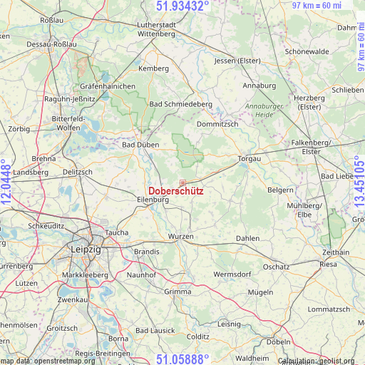
Doberschütz GPS coordinates[2]
51° 29' 55.32" North, 12° 44' 52.512" East
| Map corner | latitude | longitude |
|---|---|---|
| Upper-left | 51.93432°, | 12.0448° |
| Center: | 51.4987°, | 12.74792° |
| Lower-right: | 51.05888°, | 13.45105° |
| Map W x H: | 97.3×97.3 km | = 60.5×60.5mi |
| max Lat: | 55.01917° ⇑33.7% North |
| Doberschütz: | 51.4987° |
| min Lat: | ⇓66.3% South 47.40724° |
| min Long | Doberschütz | max Long |
| 5.92978° | 12.74792° | 14.98853° |
| W 90.3%⇐ | ⇒9.7% E |
Elevation
Elevation of Doberschütz is 106 m = 348 ft, and this is 143.1 m = 469 ft below average elevation for this country.
| Max E: |
1256 m = 4121 ft | 67.3% |
| Avg. | 249.1 m = 817 ft | |
| Doberschütz | 106 m = 348 ft | |
Min E: |
-5 m = -16 ft | 32.7% |
See also: Germany elevation on elevation.city.
Geographical zone
Doberschütz is located in North temperate zone (between Tropic of Cancer and the Arctic Circle). Distance of this North polar circle is 1675.1 km =1040.9 mi to North.| Distance of | km | miles | from Doberschütz |
|---|---|---|---|
| North Pole | 4280.9 | 2660 | to North |
| Arctic Circle | 1675.1 | 1040.9 | to North |
| Tropic Cancer | 3120.2 | 1938.8 | to South |
| Equator | 5726.1 | 3558 | to South |


Nearby cities:
15 places around Doberschütz: (largest is in red/bold)
• Bad Düben
15.3 km =9.5 mi,  312°
312°
• Bennewitz
15.5 km =9.6 mi,  188°
188°
• Eilenburg
9 km =5.6 mi,  241°
241°
• Falkenhain
14 km =8.7 mi,  142°
142°
• Hohburg
10.5 km =6.5 mi,  157°
157°
• Jesewitz
15.3 km =9.5 mi, 236°
• Kossa
13.9 km =8.6 mi,  340°
340°
• Laußig
9.8 km =6.1 mi,  303°
303°
• Mockrehna
4.7 km =2.9 mi,  77°
77°
• Schildau
13.4 km =8.3 mi,  110°
110°
• Thallwitz
8.5 km =5.3 mi,  211°
211°
• Trossin
14 km =8.7 mi,  19°
19°
• Wurzen
14.2 km =8.8 mi,  182°
182°
• Zinna
16.2 km =10.1 mi,  61°
61°
• Zschepplin
10.2 km =6.3 mi,  270°
270°
Sources, notices
• [Note1] Compared only with cities in Germany existing in our database
• [Src1] Map data: © OpenStreetMap contributors (CC-BY-SA)
• [Src2] Other city data from geonames.org with taken over terms of usage.
• [Src3] Geographical zone / Annual Mean Temperature by Robert A. Rohde @ Wikipedia
