Dahlen geodata
Dahlen (Saxony) is a populated place; located in Germany in Europe/Berlin (GMT+2) time zone. With population of 5,211 people, there are 2732 cities with bigger population in this country. Compared to other cities in Germany, 64.2% of cities are located further ↓South; 92.3% of cities are located further ←West and 60.9% of cities have higher elevation than Dahlen. Note1


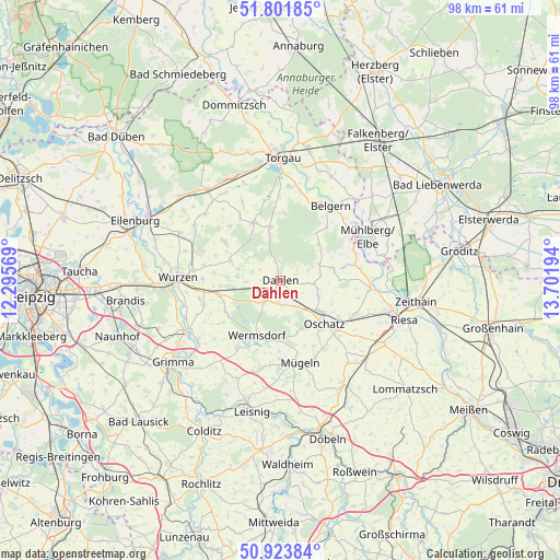
Dahlen GPS coordinates[2]
51° 21' 53.82" North, 12° 59' 55.716" East
| Map corner | latitude | longitude |
|---|---|---|
| Upper-left | 51.80185°, | 12.29569° |
| Center: | 51.36495°, | 12.99881° |
| Lower-right: | 50.92384°, | 13.70194° |
| Map W x H: | 97.6×97.6 km | = 60.6×60.6mi |
| max Lat: | 55.01917° ⇑35.8% North |
| Dahlen: | 51.36495° |
| min Lat: | ⇓64.2% South 47.40724° |
| min Long | Dahlen | max Long |
| 5.92978° | 12.99881° | 14.98853° |
| W 92.3%⇐ | ⇒7.7% E |
Elevation
Elevation of Dahlen is 146 m = 479 ft, and this is 103.1 m = 338 ft below average elevation for this country.
| Max E: |
1256 m = 4121 ft | 60.9% |
| Avg. | 249.1 m = 817 ft | |
| Dahlen | 146 m = 479 ft | |
Min E: |
-5 m = -16 ft | 39.1% |
See also: Germany elevation on elevation.city.
Geographical zone
Dahlen is located in North temperate zone (between Tropic of Cancer and the Arctic Circle). Distance of this North polar circle is 1689.9 km =1050.1 mi to North.| Distance of | km | miles | from Dahlen |
|---|---|---|---|
| North Pole | 4295.8 | 2669.3 | to North |
| Arctic Circle | 1689.9 | 1050.1 | to North |
| Tropic Cancer | 3105.3 | 1929.5 | to South |
| Equator | 5711.2 | 3548.8 | to South |


Nearby cities:
15 places around Dahlen: (largest is in red/bold)
• Belgern
15.7 km =9.8 mi,  33°
33°
• Bockelwitz
18.6 km =11.6 mi,  189°
189°
• Cavertitz
9.6 km =6 mi,  77°
77°
• Falkenhain
9.6 km =6 mi,  293°
293°
• Hohburg
14.4 km =8.9 mi, 291°
• Mutzschen
13.7 km =8.5 mi,  213°
213°
• Mügeln
14.7 km =9.1 mi,  167°
167°
• Mühlberg
17.3 km =10.7 mi,  63°
63°
• Naundorf
14.2 km =8.8 mi,  147°
147°
• Nerchau
17.9 km =11.1 mi,  234°
234°
• Oschatz
10.6 km =6.6 mi,  133°
133°
• Schildau
11.3 km =7 mi,  335°
335°
• Strehla
15.9 km =9.9 mi,  95°
95°
• Wermsdorf
9.7 km =6 mi,  200°
200°
• Wurzen
18 km =11.2 mi,  272°
272°
Sources, notices
• [Note1] Compared only with cities in Germany existing in our database
• [Src1] Map data: © OpenStreetMap contributors (CC-BY-SA)
• [Src2] Other city data from geonames.org with taken over terms of usage.
• [Src3] Geographical zone / Annual Mean Temperature by Robert A. Rohde @ Wikipedia
