Hofheim in Unterfranken geodata
Hofheim in Unterfranken (Bavaria) is a populated place; located in Germany in Europe/Berlin (GMT+2) time zone. With population of 5,199 people, there are 2742 cities with bigger population in this country. Compared to other cities in Germany, 60.4% of cities are located further ↑North; 59.3% of cities are located further ←West and 56% of cities have lower elevation than Hofheim in Unterfranken. Note1
Administrative division(s):
- Level 1: Bavaria
- Level 2: Regierungsbezirk Unterfranken
- Level 3: Landkreis Haßberge
- Level 4: Hofheim i.UFr.
Current local time in Hofheim in Unterfranken:
08:04 PM, FridayDifference from your time zone: hours


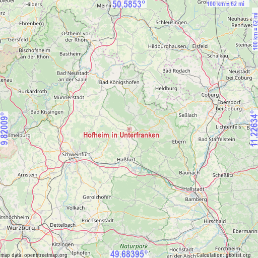
Hofheim in Unterfranken GPS coordinates[2]
50° 8' 12.3" North, 10° 31' 23.556" East
| Map corner | latitude | longitude |
|---|---|---|
| Upper-left | 50.5853°, | 9.82009° |
| Center: | 50.13675°, | 10.52321° |
| Lower-right: | 49.68395°, | 11.22634° |
| Map W x H: | 100.2×100.2 km | = 62.3×62.3mi |
| max Lat: | 55.01917° ⇑60.4% North |
| Hofheim in Unterfranken: | 50.13675° |
| min Lat: | ⇓39.6% South 47.40724° |
| min Long | Hofheim in Unte | max Long |
| 5.92978° | 10.52321° | 14.98853° |
| W 59.3%⇐ | ⇒40.7% E |
Elevation
Elevation of Hofheim in Unterfranken is 266 m = 873 ft, and this is 16.9 m = 55 ft above average elevation for this country.
| Max E: |
1256 m = 4121 ft | 44% |
| Hofheim in Unterfranken | 266 m 873 ft | |
| Avg. | 249.1 m = 817 ft | |
Min E: |
-5 m = -16 ft | 56% |
See also: Germany elevation on elevation.city.
Geographical zone
Hofheim in Unterfranken is located in North temperate zone (between Tropic of Cancer and the Arctic Circle). Distance of this North polar circle is 1826.5 km =1134.9 mi to North.| Distance of | km | miles | from Hofheim in Unterfranken |
|---|---|---|---|
| North Pole | 4432.4 | 2754.2 | to North |
| Arctic Circle | 1826.5 | 1134.9 | to North |
| Tropic Cancer | 2968.8 | 1844.7 | to South |
| Equator | 5574.7 | 3464 | to South |


Nearby cities:
15 places around Hofheim in Unterfranken: (largest is in red/bold)
• Aidhausen
6.6 km =4.1 mi,  282°
282°
• Bundorf
8.9 km =5.5 mi,  357°
357°
• Burgpreppach
9 km =5.6 mi,  86°
86°
• Ermershausen
10.8 km =6.7 mi,  42°
42°
• Gädheim
16.9 km =10.5 mi,  227°
227°
• Hausen
16.8 km =10.4 mi,  244°
244°
• Haßfurt
11.3 km =7 mi,  182°
182°
• Hellingen
17 km =10.6 mi, 42°
• Maroldsweisach
11.7 km =7.3 mi,  56°
56°
• Pfarrweisach
15 km =9.3 mi,  84°
84°
• Stadtlauringen
12.8 km =8 mi,  295°
295°
• Sulzfeld
16 km =9.9 mi,  328°
328°
• Thundorf in Unterfranken
16.2 km =10.1 mi, 296°
• Wonfurt
13.9 km =8.6 mi,  196°
196°
• Zeil
15 km =9.3 mi,  160°
160°
Sources, notices
• [Note1] Compared only with cities in Germany existing in our database
• [Src1] Map data: © OpenStreetMap contributors (CC-BY-SA)
• [Src2] Other city data from geonames.org with taken over terms of usage.
• [Src3] Geographical zone / Annual Mean Temperature by Robert A. Rohde @ Wikipedia
