Maroldsweisach geodata
Maroldsweisach (Bavaria) is a populated place; located in Germany in Europe/Berlin (GMT+2) time zone. With population of 3,788 people, there are 3412 cities with bigger population in this country. Compared to other cities in Germany, 59.1% of cities are located further ↑North; 61.8% of cities are located further ←West and 66.7% of cities have lower elevation than Maroldsweisach. Note1
Administrative division(s):
- Level 1: Bavaria
- Level 2: Regierungsbezirk Unterfranken
- Level 3: Landkreis Haßberge
- Level 4: Maroldsweisach, Markt


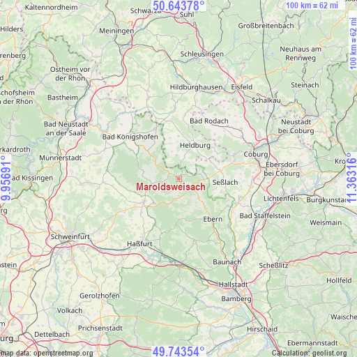
Maroldsweisach GPS coordinates[2]
50° 11' 44.808" North, 10° 39' 36.108" East
| Map corner | latitude | longitude |
|---|---|---|
| Upper-left | 50.64378°, | 9.95691° |
| Center: | 50.19578°, | 10.66003° |
| Lower-right: | 49.74354°, | 11.36316° |
| Map W x H: | 100.1×100.1 km | = 62.2×62.2mi |
| max Lat: | 55.01917° ⇑59.1% North |
| Maroldsweisach: | 50.19578° |
| min Lat: | ⇓40.9% South 47.40724° |
| min Long | Maroldsweisach | max Long |
| 5.92978° | 10.66003° | 14.98853° |
| W 61.8%⇐ | ⇒38.2% E |
Elevation
Elevation of Maroldsweisach is 333 m = 1093 ft, and this is 83.9 m = 275 ft above average elevation for this country.
| Max E: |
1256 m = 4121 ft | 33.3% |
| Maroldsweisach | 333 m 1093 ft | |
| Avg. | 249.1 m = 817 ft | |
Min E: |
-5 m = -16 ft | 66.7% |
See also: Germany elevation on elevation.city.
Geographical zone
Maroldsweisach is located in North temperate zone (between Tropic of Cancer and the Arctic Circle). Distance of this North polar circle is 1819.9 km =1130.8 mi to North.| Distance of | km | miles | from Maroldsweisach |
|---|---|---|---|
| North Pole | 4425.8 | 2750.1 | to North |
| Arctic Circle | 1819.9 | 1130.8 | to North |
| Tropic Cancer | 2975.3 | 1848.8 | to South |
| Equator | 5581.2 | 3468 | to South |


Nearby cities:
15 places around Maroldsweisach: (largest is in red/bold)
• Aidhausen
16.9 km =10.5 mi,  252°
252°
• Bundorf
10.5 km =6.5 mi,  282°
282°
• Burgpreppach
6.1 km =3.8 mi,  186°
186°
• Ermershausen
2.8 km =1.7 mi,  300°
300°
• Gompertshausen
11.7 km =7.3 mi,  347°
347°
• Hellingen
6.3 km =3.9 mi,  15°
15°
• Hofheim in Unterfranken
11.7 km =7.3 mi,  236°
236°
• Kirchlauter
17.3 km =10.7 mi,  166°
166°
• Pfarrweisach
7.3 km =4.5 mi,  134°
134°
• Seßlach
13 km =8.1 mi,  92°
92°
• Trappstadt
15.1 km =9.4 mi,  334°
334°
• Ummerstadt
12.8 km =8 mi,  57°
57°
• Untermerzbach
15.9 km =9.9 mi,  118°
118°
• Weitramsdorf
17 km =10.6 mi,  66°
66°
• Westhausen
13.3 km =8.3 mi,  0°
0°
Sources, notices
• [Note1] Compared only with cities in Germany existing in our database
• [Src1] Map data: © OpenStreetMap contributors (CC-BY-SA)
• [Src2] Other city data from geonames.org with taken over terms of usage.
• [Src3] Geographical zone / Annual Mean Temperature by Robert A. Rohde @ Wikipedia
