Hellingen geodata
Hellingen (Thuringia) is a seat of a fourth-order administrative division; located in Germany in Europe/Berlin (GMT+2) time zone. With population of 1,128 people, there are 6770 cities with bigger population in this country. Compared to other cities in Germany, 57.9% of cities are located further ↑North; 62.2% of cities are located further ←West and 61.7% of cities have lower elevation than Hellingen. Note1
Administrative division(s):
- Level 1: Thuringia
- Level 3: Landkreis Hildburghausen
- Level 4: Stadt Heldburg


Hellingen GPS coordinates[2]
50° 15' 0" North, 10° 40' 59.988" East
| Map corner | latitude | longitude |
|---|---|---|
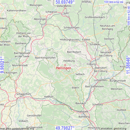
| Upper-left | 50.69749°, | 9.98021° |
| Center: | 50.25°, | 10.68333° |
| Lower-right: | 49.79827°, | 11.38646° |
| Map W x H: | 100×100 km | = 62.1×62.1mi |
| max Lat: | 55.01917° ⇑57.9% North |
| Hellingen: | 50.25° |
| min Lat: | ⇓42.1% South 47.40724° |
| min Long | Hellingen | max Long |
| 5.92978° | 10.68333° | 14.98853° |
| W 62.2%⇐ | ⇒37.8% E |
Elevation
Elevation of Hellingen is 300 m = 984 ft, and this is 50.9 m = 167 ft above average elevation for this country.
| Max E: |
1256 m = 4121 ft | 38.3% |
| Hellingen | 300 m 984 ft | |
| Avg. | 249.1 m = 817 ft | |
Min E: |
-5 m = -16 ft | 61.7% |
See also: Germany elevation on elevation.city.
Geographical zone
Hellingen is located in North temperate zone (between Tropic of Cancer and the Arctic Circle). Distance of this North polar circle is 1813.9 km =1127.1 mi to North.| Distance of | km | miles | from Hellingen |
|---|---|---|---|
| North Pole | 4419.8 | 2746.3 | to North |
| Arctic Circle | 1813.9 | 1127.1 | to North |
| Tropic Cancer | 2981.4 | 1852.6 | to South |
| Equator | 5587.3 | 3471.8 | to South |


Nearby cities:
15 places around Hellingen: (largest is in red/bold)
• Bad Königshofen im Grabfeld
16.3 km =10.1 mi,  290°
290°
• Bundorf
12.4 km =7.7 mi,  252°
252°
• Burgpreppach
12.3 km =7.6 mi,  191°
191°
• Ermershausen
6.2 km =3.9 mi,  221°
221°
• Gleichamberg
14.7 km =9.1 mi,  335°
335°
• Gompertshausen
6.8 km =4.2 mi,  322°
322°
• Herbstadt
16 km =9.9 mi,  305°
305°
• Hofheim in Unterfranken
17 km =10.6 mi, 222°
• Maroldsweisach
6.3 km =3.9 mi,  195°
195°
• Pfarrweisach
11.7 km =7.3 mi,  162°
162°
• Seßlach
13.1 km =8.1 mi,  120°
120°
• Trappstadt
11.1 km =6.9 mi, 313°
• Ummerstadt
9.2 km =5.7 mi,  84°
84°
• Weitramsdorf
14 km =8.7 mi,  87°
87°
• Westhausen
7.5 km =4.7 mi,  348°
348°
Sources, notices
• [Note1] Compared only with cities in Germany existing in our database
• [Src1] Map data: © OpenStreetMap contributors (CC-BY-SA)
• [Src2] Other city data from geonames.org with taken over terms of usage.
• [Src3] Geographical zone / Annual Mean Temperature by Robert A. Rohde @ Wikipedia
