Hemfurth-Edersee geodata
Hemfurth-Edersee (Hesse) is a populated place; located in Germany in Europe/Berlin (GMT+2) time zone. With population of 870 people, there are 7627 cities with bigger population in this country. Compared to other cities in Germany, 61.1% of cities are located further ↓South; 64.7% of cities are located further →East and 52.2% of cities have lower elevation than Hemfurth-Edersee. Note1
Administrative division(s):
- Level 1: Hesse
- Level 2: Regierungsbezirk Kassel
- Level 3: Landkreis Waldeck-Frankenberg
- Level 4: Edertal


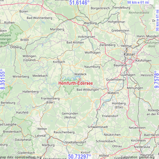
Hemfurth-Edersee GPS coordinates[2]
51° 10' 33.204" North, 9° 3' 16.848" East
| Map corner | latitude | longitude |
|---|---|---|
| Upper-left | 51.6146°, | 8.35155° |
| Center: | 51.17589°, | 9.05468° |
| Lower-right: | 50.73297°, | 9.7578° |
| Map W x H: | 98×98 km | = 60.9×60.9mi |
| max Lat: | 55.01917° ⇑38.9% North |
| Hemfurth-Edersee: | 51.17589° |
| min Lat: | ⇓61.1% South 47.40724° |
| min Long | Hemfurth-Ederse | max Long |
| 5.92978° | 9.05468° | 14.98853° |
| W 35.3%⇐ | ⇒64.7% E |
Elevation
Elevation of Hemfurth-Edersee is 241 m = 791 ft, and this is 8.1 m = 27 ft below average elevation for this country.
| Max E: |
1256 m = 4121 ft | 47.8% |
| Avg. | 249.1 m = 817 ft | |
| Hemfurth-Edersee | 241 m = 791 ft | |
Min E: |
-5 m = -16 ft | 52.2% |
See also: Germany elevation on elevation.city.
Geographical zone
Hemfurth-Edersee is located in North temperate zone (between Tropic of Cancer and the Arctic Circle). Distance of this North polar circle is 1710.9 km =1063.1 mi to North.| Distance of | km | miles | from Hemfurth-Edersee |
|---|---|---|---|
| North Pole | 4316.8 | 2682.3 | to North |
| Arctic Circle | 1710.9 | 1063.1 | to North |
| Tropic Cancer | 3084.3 | 1916.5 | to South |
| Equator | 5690.2 | 3535.7 | to South |


Nearby cities:
15 places around Hemfurth-Edersee: (largest is in red/bold)
• Bad Wildungen
7.9 km =4.9 mi,  141°
141°
• Borken
21.7 km =13.5 mi,  132°
132°
• Frankenau
12.5 km =7.8 mi,  222°
222°
• Fritzlar
16.2 km =10.1 mi,  107°
107°
• Haina
17.4 km =10.8 mi,  198°
198°
• Jesberg
20.7 km =12.9 mi,  161°
161°
• Korbach
16.8 km =10.4 mi,  311°
311°
• Martinhagen
20.3 km =12.6 mi,  52°
52°
• Naumburg
11.2 km =7 mi,  43°
43°
• Niedenstein
18.9 km =11.7 mi,  70°
70°
• Reinhardshausen
7.3 km =4.5 mi,  168°
168°
• Sachsenhausen
8.1 km =5 mi,  337°
337°
• Vöhl
8.3 km =5.2 mi,  293°
293°
• Waldeck
3.4 km =2.1 mi,  9°
9°
• Wolfhagen
18.5 km =11.5 mi,  25°
25°
Sources, notices
• [Note1] Compared only with cities in Germany existing in our database
• [Src1] Map data: © OpenStreetMap contributors (CC-BY-SA)
• [Src2] Other city data from geonames.org with taken over terms of usage.
• [Src3] Geographical zone / Annual Mean Temperature by Robert A. Rohde @ Wikipedia
