Hausen geodata
Hausen (Bavaria) is a seat of a fourth-order administrative division; located in Germany in Europe/Berlin (GMT+2) time zone. With population of 2,068 people, there are 4971 cities with bigger population in this country. Compared to other cities in Germany, 84.6% of cities are located further ↑North; 81.9% of cities are located further ←West and 72.4% of cities have lower elevation than Hausen. Note1
Administrative division(s):
- Level 1: Bavaria
- Level 2: Lower Bavaria
- Level 3: Landkreis Kelheim
- Level 4: Hausen


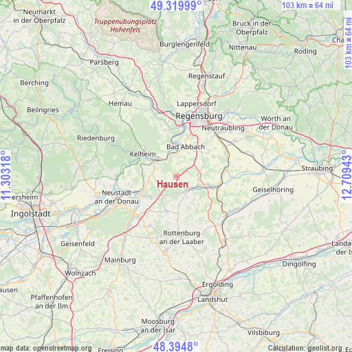
Hausen GPS coordinates[2]
48° 51' 34.308" North, 12° 0' 22.68" East
| Map corner | latitude | longitude |
|---|---|---|
| Upper-left | 49.31999°, | 11.30318° |
| Center: | 48.85953°, | 12.0063° |
| Lower-right: | 48.3948°, | 12.70943° |
| Map W x H: | 102.9×102.9 km | = 63.9×63.9mi |
| max Lat: | 55.01917° ⇑84.6% North |
| Hausen: | 48.85953° |
| min Lat: | ⇓15.4% South 47.40724° |
| min Long | Hausen | max Long |
| 5.92978° | 12.0063° | 14.98853° |
| W 81.9%⇐ | ⇒18.1% E |
Elevation
Elevation of Hausen is 377 m = 1237 ft, and this is 127.9 m = 420 ft above average elevation for this country.
| Max E: |
1256 m = 4121 ft | 27.6% |
| Hausen | 377 m 1237 ft | |
| Avg. | 249.1 m = 817 ft | |
Min E: |
-5 m = -16 ft | 72.4% |
See also: Germany elevation on elevation.city.
Geographical zone
Hausen is located in North temperate zone (between Tropic of Cancer and the Arctic Circle). Distance of this North polar circle is 1968.5 km =1223.2 mi to North.| Distance of | km | miles | from Hausen |
|---|---|---|---|
| North Pole | 4574.4 | 2842.4 | to North |
| Arctic Circle | 1968.5 | 1223.2 | to North |
| Tropic Cancer | 2826.8 | 1756.5 | to South |
| Equator | 5432.7 | 3375.7 | to South |


Nearby cities:
15 places around Hausen: (largest is in red/bold)
• Abensberg
12.4 km =7.7 mi,  247°
247°
• Alteglofsheim
15.5 km =9.6 mi,  65°
65°
• Bad Abbach
9.1 km =5.7 mi,  18°
18°
• Biburg
13.3 km =8.3 mi,  234°
234°
• Herrngiersdorf
9.2 km =5.7 mi,  148°
148°
• Ihrlerstein
13.1 km =8.1 mi,  308°
308°
• Kelheim
10.9 km =6.8 mi, 306°
• Kirchdorf
12.4 km =7.7 mi,  217°
217°
• Langquaid
5.2 km =3.2 mi,  140°
140°
• Pentling
14.3 km =8.9 mi, 15°
• Rohr
10.5 km =6.5 mi,  194°
194°
• Saal
7.1 km =4.4 mi, 310°
• Schierling
10.1 km =6.3 mi,  106°
106°
• Teugn
3.7 km =2.3 mi,  6°
6°
• Thalmassing
12.3 km =7.6 mi,  61°
61°
Sources, notices
• [Note1] Compared only with cities in Germany existing in our database
• [Src1] Map data: © OpenStreetMap contributors (CC-BY-SA)
• [Src2] Other city data from geonames.org with taken over terms of usage.
• [Src3] Geographical zone / Annual Mean Temperature by Robert A. Rohde @ Wikipedia
