Hähnichen geodata
Hähnichen (Saxony) is a seat of a fourth-order administrative division; located in Germany in Europe/Berlin (GMT+2) time zone. With population of 1,528 people, there are 5825 cities with bigger population in this country. Compared to other cities in Germany, 64.2% of cities are located further ↓South; 99.9% of cities are located further ←West and 60% of cities have higher elevation than Hähnichen. Note1


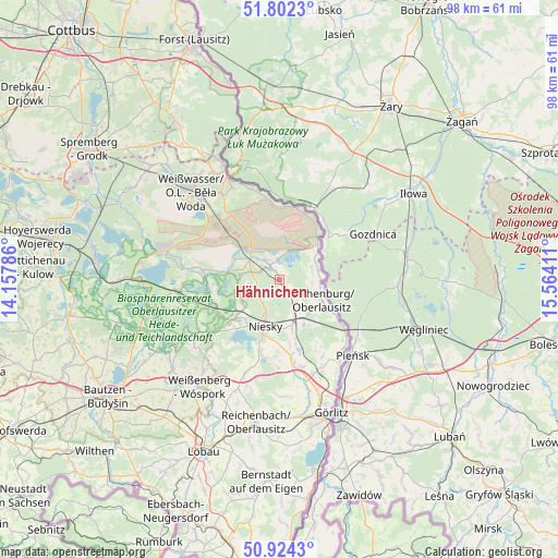
Hähnichen GPS coordinates[2]
51° 21' 55.44" North, 14° 51' 39.528" East
| Map corner | latitude | longitude |
|---|---|---|
| Upper-left | 51.8023°, | 14.15786° |
| Center: | 51.3654°, | 14.86098° |
| Lower-right: | 50.9243°, | 15.56411° |
| Map W x H: | 97.6×97.6 km | = 60.6×60.6mi |
| max Lat: | 55.01917° ⇑35.8% North |
| Hähnichen: | 51.3654° |
| min Lat: | ⇓64.2% South 47.40724° |
| min Long | Hähnichen | max Long |
| 5.92978° | 14.86098° | 14.98853° |
| W 99.9%⇐ | ⇒0.099999999999994% E |
Elevation
Elevation of Hähnichen is 153 m = 502 ft, and this is 96.1 m = 315 ft below average elevation for this country.
| Max E: |
1256 m = 4121 ft | 60% |
| Avg. | 249.1 m = 817 ft | |
| Hähnichen | 153 m = 502 ft | |
Min E: |
-5 m = -16 ft | 40% |
See also: Germany elevation on elevation.city.
Geographical zone
Hähnichen is located in North temperate zone (between Tropic of Cancer and the Arctic Circle). Distance of this North polar circle is 1689.9 km =1050.1 mi to North.| Distance of | km | miles | from Hähnichen |
|---|---|---|---|
| North Pole | 4295.8 | 2669.3 | to North |
| Arctic Circle | 1689.9 | 1050.1 | to North |
| Tropic Cancer | 3105.4 | 1929.6 | to South |
| Equator | 5711.3 | 3548.8 | to South |


Nearby cities:
15 places around Hähnichen: (largest is in red/bold)
• Bad Muskau
23 km =14.3 mi,  333°
333°
• Boxberg
20.2 km =12.6 mi,  282°
282°
• Gablenz
23 km =14.3 mi,  324°
324°
• Horka
7.8 km =4.8 mi,  159°
159°
• Klitten
17.8 km =11.1 mi,  264°
264°
• Kodersdorf
13.8 km =8.6 mi,  170°
170°
• Krauschwitz
20.2 km =12.6 mi, 329°
• Königshain
20.2 km =12.6 mi,  178°
178°
• Mücka
12.4 km =7.7 mi,  244°
244°
• Niesky
8.6 km =5.3 mi,  198°
198°
• Quitzdorf
11.2 km =7 mi,  215°
215°
• Rietschen
6.6 km =4.1 mi,  305°
305°
• Rothenburg
8.3 km =5.2 mi,  115°
115°
• Weißkeißel
17.5 km =10.9 mi, 324°
• Weißwasser
21.7 km =13.5 mi, 315°
Sources, notices
• [Note1] Compared only with cities in Germany existing in our database
• [Src1] Map data: © OpenStreetMap contributors (CC-BY-SA)
• [Src2] Other city data from geonames.org with taken over terms of usage.
• [Src3] Geographical zone / Annual Mean Temperature by Robert A. Rohde @ Wikipedia
