Boxberg geodata
Boxberg (Saxony) is a populated place; located in Germany in Europe/Berlin (GMT+2) time zone. With population of 3,093 people, there are 3919 cities with bigger population in this country. Compared to other cities in Germany, 64.8% of cities are located further ↓South; 99.5% of cities are located further ←West and 63% of cities have higher elevation than Boxberg. Note1


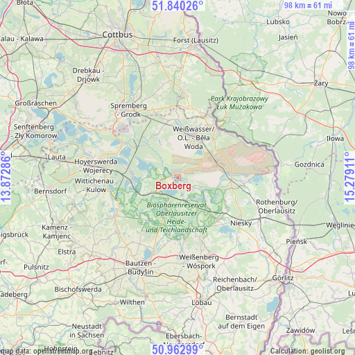
Boxberg GPS coordinates[2]
51° 24' 13.428" North, 14° 34' 33.528" East
| Map corner | latitude | longitude |
|---|---|---|
| Upper-left | 51.84026°, | 13.87286° |
| Center: | 51.40373°, | 14.57598° |
| Lower-right: | 50.96299°, | 15.27911° |
| Map W x H: | 97.5×97.5 km | = 60.6×60.6mi |
| max Lat: | 55.01917° ⇑35.2% North |
| Boxberg: | 51.40373° |
| min Lat: | ⇓64.8% South 47.40724° |
| min Long | Boxberg | max Long |
| 5.92978° | 14.57598° | 14.98853° |
| W 99.5%⇐ | ⇒0.5% E |
Elevation
Elevation of Boxberg is 132 m = 433 ft, and this is 117.1 m = 384 ft below average elevation for this country.
| Max E: |
1256 m = 4121 ft | 63% |
| Avg. | 249.1 m = 817 ft | |
| Boxberg | 132 m = 433 ft | |
Min E: |
-5 m = -16 ft | 37% |
See also: Germany elevation on elevation.city.
Geographical zone
Boxberg is located in North temperate zone (between Tropic of Cancer and the Arctic Circle). Distance of this North polar circle is 1685.6 km =1047.4 mi to North.| Distance of | km | miles | from Boxberg |
|---|---|---|---|
| North Pole | 4291.5 | 2666.6 | to North |
| Arctic Circle | 1685.6 | 1047.4 | to North |
| Tropic Cancer | 3109.6 | 1932.2 | to South |
| Equator | 5715.6 | 3551.5 | to South |


Nearby cities:
15 places around Boxberg: (largest is in red/bold)
• Gablenz
15.7 km =9.8 mi,  23°
23°
• Groß Düben
18.1 km =11.2 mi,  357°
357°
• Großdubrau
18.5 km =11.5 mi,  206°
206°
• Guttau
16.1 km =10 mi,  183°
183°
• Klitten
6.2 km =3.9 mi,  160°
160°
• Knappenrode
17.7 km =11 mi,  269°
269°
• Krauschwitz
16.1 km =10 mi,  35°
35°
• Lohsa
12.4 km =7.7 mi,  259°
259°
• Mücka
13 km =8.1 mi,  138°
138°
• Rietschen
14.4 km =8.9 mi,  91°
91°
• Schleife
14.7 km =9.1 mi,  348°
348°
• Trebendorf
14.4 km =8.9 mi, 357°
• Uhyst
6.5 km =4 mi,  228°
228°
• Weißkeißel
13.9 km =8.6 mi, 43°
• Weißwasser
12 km =7.5 mi, 21°
Sources, notices
• [Note1] Compared only with cities in Germany existing in our database
• [Src1] Map data: © OpenStreetMap contributors (CC-BY-SA)
• [Src2] Other city data from geonames.org with taken over terms of usage.
• [Src3] Geographical zone / Annual Mean Temperature by Robert A. Rohde @ Wikipedia
