Gutach im Breisgau geodata
Gutach im Breisgau (Baden-Württemberg) is a seat of a fourth-order administrative division; located in Germany in Europe/Berlin (GMT+2) time zone. With population of 4,429 people, there are 3075 cities with bigger population in this country. Compared to other cities in Germany, 93.9% of cities are located further ↑North; 77.5% of cities are located further →East and 75.2% of cities have lower elevation than Gutach im Breisgau. Note1
Administrative division(s):
- Level 1: Baden-Württemberg
- Level 2: Freiburg Region
- Level 3: Landkreis Emmendingen
- Level 4: Gutach im Breisgau


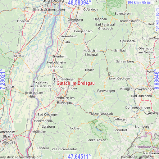
Gutach im Breisgau GPS coordinates[2]
48° 7' 0.012" North, 7° 58' 59.988" East
| Map corner | latitude | longitude |
|---|---|---|
| Upper-left | 48.58394°, | 7.28021° |
| Center: | 48.11667°, | 7.98333° |
| Lower-right: | 47.64511°, | 8.68646° |
| Map W x H: | 104.4×104.4 km | = 64.9×64.9mi |
| max Lat: | 55.01917° ⇑93.9% North |
| Gutach im Breisgau: | 48.11667° |
| min Lat: | ⇓6.1% South 47.40724° |
| min Long | Gutach im Breis | max Long |
| 5.92978° | 7.98333° | 14.98853° |
| W 22.5%⇐ | ⇒77.5% E |
Elevation
Elevation of Gutach im Breisgau is 399 m = 1309 ft, and this is 149.9 m = 492 ft above average elevation for this country.
| Max E: |
1256 m = 4121 ft | 24.8% |
| Gutach im Breisgau | 399 m 1309 ft | |
| Avg. | 249.1 m = 817 ft | |
Min E: |
-5 m = -16 ft | 75.2% |
See also: Germany elevation on elevation.city.
Geographical zone
Gutach im Breisgau is located in North temperate zone (between Tropic of Cancer and the Arctic Circle). Distance of this North polar circle is 2051.1 km =1274.5 mi to North.| Distance of | km | miles | from Gutach im Breisgau |
|---|---|---|---|
| North Pole | 4657 | 2893.7 | to North |
| Arctic Circle | 2051.1 | 1274.5 | to North |
| Tropic Cancer | 2744.2 | 1705.2 | to South |
| Equator | 5350.1 | 3324.4 | to South |


Nearby cities:
15 places around Gutach im Breisgau: (largest is in red/bold)
• Denzlingen
9.3 km =5.8 mi,  233°
233°
• Elzach
8.9 km =5.5 mi,  45°
45°
• Emmendingen
9.6 km =6 mi,  272°
272°
• Glottertal
7.5 km =4.7 mi,  191°
191°
• Gundelfingen
12 km =7.5 mi, 226°
• Gütenbach
14.4 km =8.9 mi,  120°
120°
• Heuweiler
9.7 km =6 mi,  219°
219°
• Sankt Märgen
14.6 km =9.1 mi,  146°
146°
• Sankt Peter
11.9 km =7.4 mi,  161°
161°
• Sexau
5.9 km =3.7 mi,  253°
253°
• St. Peter
11.7 km =7.3 mi, 161°
• Stegen
14.9 km =9.3 mi,  184°
184°
• Teningen
12.8 km =8 mi,  276°
276°
• Vörstetten
11.4 km =7.1 mi,  240°
240°
• Waldkirch
2.7 km =1.7 mi,  212°
212°
Sources, notices
• [Note1] Compared only with cities in Germany existing in our database
• [Src1] Map data: © OpenStreetMap contributors (CC-BY-SA)
• [Src2] Other city data from geonames.org with taken over terms of usage.
• [Src3] Geographical zone / Annual Mean Temperature by Robert A. Rohde @ Wikipedia
