Gundelsheim geodata
Gundelsheim (Baden-Württemberg) is a populated place; located in Germany in Europe/Berlin (GMT+2) time zone. With population of 7,551 people, there are 2056 cities with bigger population in this country. Compared to other cities in Germany, 79% of cities are located further ↑North; 63% of cities are located further →East and 59.7% of cities have higher elevation than Gundelsheim. Note1
Administrative division(s):
- Level 1: Baden-Württemberg
- Level 2: Regierungsbezirk Stuttgart
- Level 3: Landkreis Heilbronn
- Level 4: Gundelsheim


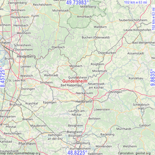
Gundelsheim GPS coordinates[2]
49° 16' 59.88" North, 9° 9' 37.332" East
| Map corner | latitude | longitude |
|---|---|---|
| Upper-left | 49.73983°, | 8.45725° |
| Center: | 49.2833°, | 9.16037° |
| Lower-right: | 48.8225°, | 9.8635° |
| Map W x H: | 102×102 km | = 63.4×63.4mi |
| max Lat: | 55.01917° ⇑79% North |
| Gundelsheim: | 49.2833° |
| min Lat: | ⇓21% South 47.40724° |
| min Long | Gundelsheim | max Long |
| 5.92978° | 9.16037° | 14.98853° |
| W 37%⇐ | ⇒63% E |
Elevation
Elevation of Gundelsheim is 155 m = 509 ft, and this is 94.1 m = 309 ft below average elevation for this country.
| Max E: |
1256 m = 4121 ft | 59.7% |
| Avg. | 249.1 m = 817 ft | |
| Gundelsheim | 155 m = 509 ft | |
Min E: |
-5 m = -16 ft | 40.3% |
See also: Germany elevation on elevation.city.
Geographical zone
Gundelsheim is located in North temperate zone (between Tropic of Cancer and the Arctic Circle). Distance of this North polar circle is 1921.4 km =1193.9 mi to North.| Distance of | km | miles | from Gundelsheim |
|---|---|---|---|
| North Pole | 4527.3 | 2813.1 | to North |
| Arctic Circle | 1921.4 | 1193.9 | to North |
| Tropic Cancer | 2873.9 | 1785.8 | to South |
| Equator | 5479.8 | 3405 | to South |


Nearby cities:
15 places around Gundelsheim: (largest is in red/bold)
• Bad Rappenau
6.5 km =4 mi,  220°
220°
• Bad Wimpfen
6 km =3.7 mi,  182°
182°
• Billigheim
9.9 km =6.2 mi,  43°
43°
• Binau
12 km =7.5 mi,  321°
321°
• Haßmersheim
2 km =1.2 mi,  337°
337°
• Hüffenhardt
5.8 km =3.6 mi,  279°
279°
• Mosbach
7.8 km =4.8 mi,  355°
355°
• Neckarsulm
11.5 km =7.1 mi,  155°
155°
• Neckarzimmern
4.5 km =2.8 mi,  333°
333°
• Neudenau
8 km =5 mi,  83°
83°
• Obrigheim
9.1 km =5.7 mi, 326°
• Oedheim
8.3 km =5.2 mi,  125°
125°
• Offenau
4.2 km =2.6 mi, 179°
• Siegelsbach
5.3 km =3.3 mi,  253°
253°
• Untereisesheim
8.6 km =5.3 mi, 159°
Sources, notices
• [Note1] Compared only with cities in Germany existing in our database
• [Src1] Map data: © OpenStreetMap contributors (CC-BY-SA)
• [Src2] Other city data from geonames.org with taken over terms of usage.
• [Src3] Geographical zone / Annual Mean Temperature by Robert A. Rohde @ Wikipedia
