Glienicke geodata
Glienicke (Brandenburg) is a populated place; located in Germany in Europe/Berlin (GMT+2) time zone. With population of 9,144 people, there are 1761 cities with bigger population in this country. Compared to other cities in Germany, 79.2% of cities are located further ↓South; 94.5% of cities are located further ←West and 77.9% of cities have higher elevation than Glienicke. Note1
Administrative division(s):
- Level 1: Brandenburg
- Level 3: Landkreis Oberhavel
- Level 4: Glienicke/Nordbahn


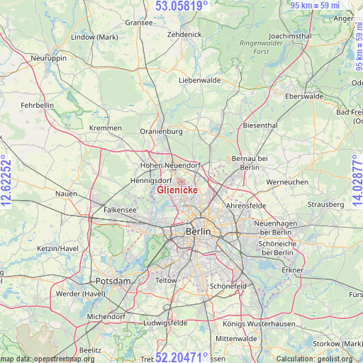
Glienicke GPS coordinates[2]
52° 38' 0.708" North, 13° 19' 32.304" East
| Map corner | latitude | longitude |
|---|---|---|
| Upper-left | 53.05819°, | 12.62252° |
| Center: | 52.63353°, | 13.32564° |
| Lower-right: | 52.20471°, | 14.02877° |
| Map W x H: | 94.9×94.9 km | = 59×59mi |
| max Lat: | 55.01917° ⇑20.8% North |
| Glienicke: | 52.63353° |
| min Lat: | ⇓79.2% South 47.40724° |
| min Long | Glienicke | max Long |
| 5.92978° | 13.32564° | 14.98853° |
| W 94.5%⇐ | ⇒5.5% E |
Elevation
Elevation of Glienicke is 53 m = 174 ft, and this is 196.1 m = 643 ft below average elevation for this country.
| Max E: |
1256 m = 4121 ft | 77.9% |
| Avg. | 249.1 m = 817 ft | |
| Glienicke | 53 m = 174 ft | |
Min E: |
-5 m = -16 ft | 22.1% |
See also: Germany elevation on elevation.city.
Geographical zone
Glienicke is located in North temperate zone (between Tropic of Cancer and the Arctic Circle). Distance of this North polar circle is 1548.9 km =962.4 mi to North.| Distance of | km | miles | from Glienicke |
|---|---|---|---|
| North Pole | 4154.8 | 2581.7 | to North |
| Arctic Circle | 1548.9 | 962.4 | to North |
| Tropic Cancer | 3246.4 | 2017.2 | to South |
| Equator | 5852.3 | 3636.4 | to South |


Nearby cities:
15 places around Glienicke: (largest is in red/bold)
• Birkenwerder
6.2 km =3.9 mi,  332°
332°
• Blankenfelde
4.7 km =2.9 mi,  110°
110°
• Frohnau
2.4 km =1.5 mi,  269°
269°
• Heiligensee
5.8 km =3.6 mi,  248°
248°
• Hermsdorf
2.5 km =1.6 mi,  211°
211°
• Hohen Neuendorf
5.7 km =3.5 mi, 325°
• Lübars
2.7 km =1.7 mi,  136°
136°
• Märkisches Viertel
4.5 km =2.8 mi,  151°
151°
• Niederschönhausen
7.5 km =4.7 mi, 136°
• Reinickendorf
7.5 km =4.7 mi,  176°
176°
• Rosenthal
5.1 km =3.2 mi, 136°
• Tegel
6.7 km =4.2 mi,  198°
198°
• Waidmannslust
3 km =1.9 mi,  187°
187°
• Wilhelmsruh
5.9 km =3.7 mi, 150°
• Wittenau
4.5 km =2.8 mi, 183°
Sources, notices
• [Note1] Compared only with cities in Germany existing in our database
• [Src1] Map data: © OpenStreetMap contributors (CC-BY-SA)
• [Src2] Other city data from geonames.org with taken over terms of usage.
• [Src3] Geographical zone / Annual Mean Temperature by Robert A. Rohde @ Wikipedia
